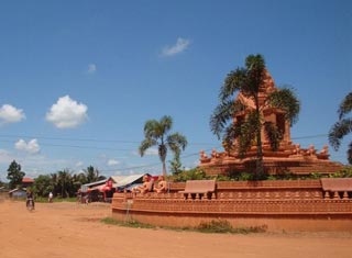
Tuesday, January 26, 2016

Stung Treng Province

General Information

Stung Treng is a northern province of Cambodia. It was formerly called Xieng Teng and was once a part of the vast Khmer Empire, then the Lao kingdom of Lan Xang and later the Lao kingdom of Champassack. During the period of French Indochina it was again ceded to Cambodia.
The provincial capital is also named Stung Treng and is an important trade hub with a few hints of Lao influence scattered about, owing to the fact that the Lao border is about 50 km away. It's a friendly, quiet country town situated on the confluence of the San River and the Mekong River. It actually sits on the banks of the San River, with the mighty Mekong coming into the picture on the northeastern outskirts of he town.

The San River goes by three names, depending on which of the locals you speak to. Some call it the Kong River because the San and Kong Rivers merge together about 10 km northeast of Stung Treng town, confusing people about which name the river should bear. Others call it the Sekong River, which is the combined name of these two rivers. Whatever name the fiver beside the town goes by, it's another one of Cambodia's beautiful picture-postcard river towns. It's a nice place to kick back and chill out if you are on a circuit tour of the Northeast River Scene, from here to Laos.

The San River is fronted in Stung Treng by a nice stretch of paved road. It's the centre of socializing (as in most Cambodian river towns) in the late afternoon and early evening hours as the locals ride up and down the stretch enjoying the view and each other. Drink and dessert stands spring up earlier to serve the daily merrymaking crowd. It's a nice spot for a walk or jog any time of the day as the river road turns into a pleasant rural road that leads to the airport 4 km north of town.

The river port area just in front of the small city park is fairly busy, handling trade between Cambodia and Laos. The ferry across the San River to where National Highway No 7 continues north to the Laos border is also at this pier. The fare is 300 riel per head. We went for a ride on this stretch (2,000 riel for taking a big bike on the ferry), but there is not much to see along the way besides light jungle and some remnants next to the road that was a target of carpet bombing during the Vietnam War years (the road was recently overhauled and is now one of the best in the country). The road works its way eastward so it does not afford views of the Mekong River as one would hope. The few residents we saw along the way were truly amazed to see the likes of us, who would want to be there.
Geography

Stung Treng province, which covers an area of 11,092 square kilometres, is a remote and sparsely populated province in the northeast of Cambodia. It borders Lao to the north, Ratanakiri to the east, Preah Vihear to the west and Kratie and Kompong Thom to the south. The province is divided into five district, 34 communes and 128 villages.

Stung Treng is a unique province quite distinct from other Cambodian provinces in the Mekong basin.Extensive forests, intersecting rivers and streams and low population density characterize it. Stung Treng includes also the western chunk of the massive Virachey National Park, accessible from Siem Pang, a small beautiful town on the Tonle Kong. The province also features three big rivers the Tonle Kong, the Tonle San and the mighty Mekong with its hundreds of small islands scattered on the river stretch in Stung Treng Province.
Population

The population of Stung Treng constitutes just 0.7% of Cambodia's population. The population density is 7 people per square kilometre, which is nine times less than the national density. As the population is low and the province is endowed with natural resources, the immigration rate is very high. This fact has been proven by the population census in 1998, which shows that 19.4% of the province's population has migrated from outside, of which male migrants constitute 55%. The most commonly stated reasons for immigration were moving with family, followed by searching for livelihood.

Similar with other provinces, the female population is higher than the male population. The result of the census in 1998 demonstrates that 50.5% of the population is female. In Stung Treng, about 79.4% of the population are involved in the agriculture sector. The secondary and tertiary sectors account for 2.4% and 18.2% respectively. There are 54,488 male and 55,217 female with a total of 109,705person.
Climate

The country has a tropical climate - warm and humid. In the monsoon season, abundant rain allows for the cultivation of a wide variety of crops. This year-round tropical climate makes Cambodia ideal for developing tourism. Travellers need not to fear natural disasters such as erupting volcanoes or earthquakes, and the country is not directly affected by tropical storms.

Climate: Cambodia can be visited throughout the year. However, those plans to travel extensively by road should be avoided the last two months of the rainy season when some countryside roads may be impassable. The average temperature is about 27 degrees Celsius; the minimum temperature is about 16 degrees. December and January are the coolest months, whereas the hottest is April.

General information about the provincial climate:
- Cool season: November- March (18-26c)
- Hot season: March- May (27c -35c)
- Rainy season: May - October (26-34c, with humidity up to 90%.)
Economy

Stung Treng's economy is based on fishing and silk weaving. However there is also some agricultural farming what is the smallest economical source of the province.

Hopefully the ministry of tourism can manage its newly created development plan.
The last river dolphins (Irrawaddy) in the Mekong River are at the heart of an ambitious development programme to tackle poverty and attract tens of thousands of visitors to the province. The Mekong River Discovery Trail Project will draw visitors to view the endangered fresh water dolphin, which lives in 10 deep-water natural pools in a 190-km stretch of the Mekong River, mostly between the quiet provincial capitals of Kratie and Stung Treng.

Siem Reap Province

General Information

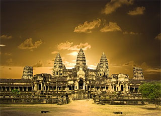
Siem Reap province is located in northwest Cambodia. It is the major tourist hub in Cambodia, as it is the closest city to the world famous temples of Angkor (the Angkor temple complex is north of the city). The provincial capital is also called Siem Reap and is located in the South of the province on the shores of the Tonle Sap Lake, the greatest sweet water reserve in whole Southeast Asia. The name of the city literally means Siamese defeated, referring to the victory of the Khmer Empire over the army of the Thai kingdom in the 17th century.

At the turn of the millennium Siem Reap was a Cambodian provincial town with few facilities, minor surfaced roads and little in the way of nightlife. Tourism industry catered largely to hardy backpackers willing to brave the tortuous road from the Thai border on the tailgate of a local pick-up truck. There were a couple of large hotels and a handful of budget guesthouses. Tuk-tuks and taxis were non-existent and the trusty motodup was the chosen means of touring the temples of Angkor.

The proximity of the Angkorian ruins turned Siem Reap into a boomtown in less than half a decade. Huge, expensive hotels have sprung up everywhere and budget hotels have mushroomed. Property values have soared to European levels and tourism has become a vast, lucrative industry. The Siem Reap of today is barely recognizable from the Siem Reap of the year 2000.

Though some of the town's previous ramshackle charm may have been lost the developments of the last few years have brought livelihoods, if not significant wealth, to a good number of its citizens. This has been at a cost to the underprivileged people living within and beyond the town's limits that now pay inflated prices at the central markets and continue to survive on poorly paid subsistence farming and fishing. If Cambodia is a country of contrasts Siem Reap is the embodiment of those contrasts. Despite the massive shift in its economic fortunes, Siem Reap remains a safe, friendly and pleasant town. There is an endless choice of places to stay or dine and a host of possible activities awaiting the visitor.
Geography

Siem Reap province is 10,299 square kilometres big and definitely one of the most famous ones in Cambodia. It's located in the Northwest of the country bordering to the North with Oddor Meanchey, to the East with Preah Vihear and Kampong Thom, to the West with Banteay Meanchey and to the South with the biggest sweet water reserve in Southeast Asia, the huge Tonle Sap Lake.

The province in general, especially in the Southern part consists of the typical plain wet area for Cambodia, covering lots of rice fields and other agricultural plantations. The northern part is turning into an undulating area covered with some deeper, green forests. A quite distinguished mark of Siem Reap Province is the smaller, but important Siem Reap River. It rises from Phnom Kulen, meanders through the northern part of Siem Reap Province and eventually into the Tonle Sap Lake.
Population

The current population in this province is about 903,030 people or 6.3% of the country's total population (14,363,519 person in Cambodia, 2007, provincial government data), with 440,395 male and 462,635 female. The population density is therefore 87,7 people per square kilometre.
Climate

The country has a tropical climate - warm and humid. In the monsoon season, abundant rain allows for the cultivation of a wide variety of crops. This year-round tropical climate makes Cambodia ideal for developing tourism. Travellers need not to fear natural disasters such as erupting volcanoes or earthquakes, and the country is not directly affected by tropical storms.

Climate: Cambodia can be visited throughout the year. However, those plans to travel extensively by road should be avoided the last two months of the rainy season when some countryside roads may be impassable. The average temperature is about 27 degrees Celsius; the minimum temperature is about 16 degrees. December and January are the coolest months, whereas the hottest is April. General information about the provincial climate:- Cool season: November- March (23-29c)
- Hot season: March- May (27c -37c)
- Rainy season: May - October (24-33c, with humidity up to 90%.)
Economy

Generally spoken Siem Reap Province is all in all economically focusing on the foreign tourism due to the famous Angkor Temples. Since of the year 2000 the economical growth rate is gaining double-digits. It's all sub-sectors such as hotels, restaurants, bars, entertainment places and transportation to profit from the annual influx of tourists, which was in 2007 more than 1,000,000 people.

Except the tourism sector the provincial economy was and still is growing due to the enforced fishery. Thousands of tons are annually exported to other provinces within the country or outside Cambodia. Farming and fruit cropping has probably become a minor profitable sector, but is still done by the vast poor rural population, who are the underdogs regarding the annual provincial revenue.

Rattanakiri Province

General Information

Ratanakiri is located in Cambodia's far northeast bordered by Laos to the north, Vietnam to the east, Mondulkiri to the south, and Stung Treng to the west. This rural rugged province is a 70% ethnic minority, which are known as "Chunchiet". Ratanakiri was as recently as 2002 seriously off the beaten track but has since been "discovered" step by step.

Still, while you won't get any bragging rights for coming here, it's well worth the effort to do so, and once you get away from it's capital Banlung you won't run into too many other tourists. So Ratanakiri is still a remote province in Northeastern Cambodia worth to visit. The word "Ratanakiri" itself is a derivative of two Cambodian words, which are combined to mean "place of gems and mountains." The word comes from the Sanskrit words Ratna (gem) and giri (mountain).

It's quite dusty capital, Banlung, is located in the central highlands of the province, approximately 365 miles (586 kilometres) from Phnom Penh and reminds one of a wild western city, even if it's the wild east. Its wide red laterite roads are bordered by new, recently build houses replacing the older ones. The centre of the town features a lively marked with all the needful things.

Lomphat is a small town in the southern plains, which was once the former capital of Ratanakiri. There are a few other small towns like Ta Veng and Voen Sai. The province is getting more and more popular for thousands of tourist every year. Especially for those, who seek a close contact to originality, hidden roots of ethnic groups and abundant wildlife. Therefore the Ecotourism abounds, due to lush wildlife and remote tribal villages. Most of the inhabitants of Ratanakiri are indigenous minorities.

Ethnic Cambodians make up only 10-20% of the country's total population. Remnants of an ancient volcano exist near to Banlung in the form of a crystal-clear lake that was formed after the active volcano went dormant. There are also a few ancient lava fields that testify to the fact that the area was quite lively at one time. Beautiful waterfalls, clear rivers winding through stretches of jungle, and rolling hills that meet mountains near the Vietnamese and Lao border provide a full agenda for nature lovers. Non-structured, low-impact, custom trips to outlying villages and natural areas can be organized (strictly by yourself or with help from a guesthouse).

There is a few foreigners living in Banlung you'll definitely meet while walking in the streets you can ask for actual tour offers, prices etc (change spontaneously). You will soon realize that this area hasn't seen a lot of tourists in the past. If you will visit the hill tribe people in the further areas outside of Banlung, don't be surprised if they look appalled at you. They just haven't seen many, if any, foreigners.

Yeak Laom Volcano Lake: This beautiful place is not far from town and is great for a swim, picnic, or hike around the crater rim of the old volcano. Due to the lake's tremendous depth of 48 meters, its water is exceptionally clean and crystal clear. The lake is almost perfectly round and measures around 750 meters in diameter. It has a small informative local museum thrown in to boot. In 1995 the governor of Ratanakiri officially set aside a 5,000-hectare (12,350-acre) protected area, of which the lake is a part, and in 1996 got help from the International Development and Research Centre of Canada and the United Nations Development Program to develop an effective resource management program.

This area represents Cambodia's finest attempt at preserving a site. Full-time rangers work to ensure the area is protected. They receive regular training and have put up signs throughout the area reminding people not too littler, wash clothes or toilet in the lake. That's amazing for Cambodia. The main swimming and picnic area features a nice wood deck that's great to use for a jump into the crystal clean water. Nearby, park rangers erected a couple of examples of hill tribe construction in the form of non politically correct bride and groom homes, where the man gets the elevated home (his status in the relationship) and the woman has the one nearer to the ground.

A few hundred meters down is the Cultural and Environmental Centre, which has information about area history and displays of local hill tribe tools and handiwork. They also sell some of the handicrafts made by the hill tribes: musical instruments, beaded belts, shirts, and hats. From the centre you can take a nature trail around the entire crater rim. King Sihanouk had a chalet built on the shores of the lake and used it during the 1960s. It was destroyed in the 1970 war between the Lon Nol government and Khmer Rouge guerrillas.

You can still see the remnants of this and also-indifferent spots around the lake-trenches that held gun emplacements during the fighting. The original inhabitants of the area are the Khmer Leu hill tribe people, who have always recognized the lake as a sacred place, home to the spirits of the land, water, and forest. Here those spirits interact with humans and, according to the local legend of Yeak Laom Lake, fabulous, spiritual aquatic beings reside here.

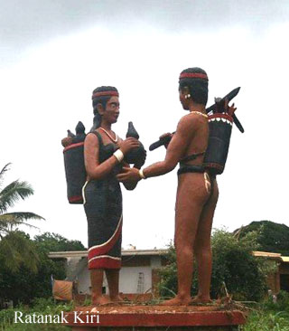
The surrounding forests of the area are also said to be the home of spirits and therefore can't be cut. This helps to explain why the hill tribe people took so strongly to the idea of protecting the area. It's very easy to get there - just go east from the Independence Monument circle 3 km to the Hill Tribe Monument circle (two indigenous figures) and go right for about 1,5 km to the entrance gate. The local hill tribe community connected to the lake get to collect an entrance fee, giving them a source of income and revenue for protecting their resource. It?s US$1 per person and a few hundred riels for a motorcycle.
Geography

Ratanakiri is situated on the north - east plateau (approx. altitude around 200-400 metres), 636 Km from Phnom Penh. It is bordering Vietnam on the east, Laos PDR on the North, Steung Treng province on the West and Mondulkiri on the South. There are two bigger rivers crossing the province ( Sre Pork and Sresan River ). The total area of Ratanakiri is about 10,782 square kilometres.
Population

There are 8 different hill tribes ethnic groups in Ratanakiri. Most of them live in the deeper jungle, on the hills and covered mountains in small separated villages. Usualy they make their living through traditional ways of cultivation ( shifting agriculture), hunting and collecting fruits from the forest is a must. These old cultures believe in spirits, derived from their animism beliefs. In the whole province there are 63,333 male and 64,774 female with a total of 128,107 inhabitants living. This is 11.8 inhabitans/km.
Climate

Ratanakiri Province has a climate like the other areas in the country, there are 3 seasons : - Rainy season: June - October (<27c) - Cool season: November- February (>24c) - Hot season: March- May : Temperature: from 20c -32c Ratanakiri's average temperature throughout the year is definately lower than in the other areas of Cambodia (except Mondulkiri Province).
Economy

The vast majority of the indigenous peoples living in Ratanakiri are subsistence farmers, who are planting rice, corn, pumpkins etc. Some of them grow an additional catch crop such as peanuts or cashews. There is quite a number of wealthy Cambodians and Vietnamese, who own large plantations surrounding the capital of Banlung. Most of them plant peanuts, coffee, or cashews.

Additionally, Ratanakiri boasts hundreds of square miles of lucrative rubber plantations, of which rubber is mostly exported to neighbouring Vietnam. Due to the present reconstruction of the Cambodian National Highway 19, which runs through the center of the capital of Banlung, the area's trade with Vietnam will soon rise. Anyhow Ratanakiri is so sparsely populated that the Provincial capital does not have an adequate market compete to other provinces of Cambodia. But in mineral wealth alone, Ratanakiri boasts gold, gemstones, granite and onyx. Fertile red soil, water sources, wild animals and quality hardwoods abound and the weather and scenery are perennial assets.

Pursat Province

General Information

Pursat is the fourth biggest province of Cambodia. The province is located in the western part of the country and borders clockwise from the north with Battambang, the Tonle Sap Lake, Kompong Chhnang, Kompong Speu, Koh Kong, and Thailand. Pursat offers a perfect access to both the Tonle Sap (just 35km far) and the Cardamom Mountains (right to the West). The name of Pursat refers to a type of tree.
For the time being, Pursat receives few travellers and the two main attractions, the Cardamoms and the Tonle Sap require a little initiative on the tourist's part to visit. Pursat is predominantly accessible by the National Highway No 5 form Phnom Penh (174km) and Battambang (106km). There is also an old slowly train working between Phnom Penh and Battambang, which stops outside (2km) from Pursat.

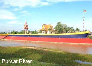
The provincial capital of Pursat is also called Pursat town. The city is located right in the middle between the Tonle Sap and the Cardamom Mountains on the riverbanks of the Stung Pursat. There isn?t that much to do in that small town, so most of the tourists coming here are more or less on their way to Battambang or Phnom Penh. For people just driving by, the impression of a boring ordinary town remains. The only tourist attraction in town is the marble workshops near the bridge on the main street. The precious marble stones originate from the Cardamoms, than they are brought here, followed up and sold near the Lam Siv Eng Restaurant. About 5 km from town is the tomb of Khleang Meung.

The Tonle Sap
Pursat province offers the magnificent opportunity to see one of the larger and markedly less touristy floating villages without a significant investment in time or money. In fact, there are a number of floating villages in the province only accessible from the lake, Peach Kantil, Kbal Taol, and Prek Kr, but you can only see Kompong Luong for the cost of the day-rate for a moto ($6-8) and the cost for a boat ride once you get there.

Central Cardamoms
Pursat offers a relatively easy way to enter this fantastic ecological wonder, the massive Cardamom Mountains. Accessing the central Cardamoms from Pursat is not too difficult as there is a road from Pursat to Veal Veng, a small village between the Mt. Samkos and Mt. Aural Wildlife Sanctuaries. There's really nothing to do but to take a drive through the country, to have a look at the mountains, and to talk to people who don't see many foreigners ? and that is even worth it. There's no organized transport from Pursat to this place, but if you ask around you should eventually get satisfactory results.
Geography

Pursat province is 12,692 square kilometres big. It?s located in the Southwest of the country and is bordering to the North with Battambang, to the East with Kampong Chhnang, to the South with Kampong Speu and Koh Kong and to the West with Thailand. The province consists of some typical plain wet areas near the Tonle Sap Basin, covering rice fields and other agricultural plantations. The Tonle Sap itself covers a big part in the province?s Northeast. Most surface area of the country is the Kr?vanh Mountains, or literally called "Cardamom Mountains". This is a green, forested mountain range in the southwestern part of the province, near to the border with Thailand. The highest elevation is the 1,813m high Phnom Aural in the Southeast corner of the country.

Population

The current population in this province is about 442,973 people or 3.1% of the country?s total population (14,363,519 person in Cambodia, 2007, provincial government data), with 214,651 male and 228,342 female. The population density is therefore 35 people per square kilometre.

Climate

The country has a tropical climate - warm and humid. In the monsoon season, abundant rain allows for the cultivation of a wide variety of crops. This year-round tropical climate makes Cambodia ideal for developing tourism. Travellers need not to fear natural disasters such as erupting volcanoes or earthquakes, and the country is not directly affected by tropical storms.

Climate: Cambodia can be visited throughout the year. However, those plans to travel extensively by road should be avoided the last two months of the rainy season when some countryside roads may be impassable. The average temperature is about 27 degrees Celsius; the minimum temperature is about 16 degrees. December and January are the coolest months, whereas the hottest is April.

General information about the provincial climate:

- Cool season: November- March (18-28c)
- Hot season: March- May (22c -34c)
- Rainy season: May - October (22-32c, with humidity up to 90%.)

Pursat?s average temperature throughout the year is definitely lower than in other areas of Cambodia (except Ratanakiri and Mondulkiri Province).

Economy

Pursat's economy consists basically of agricultural farming, fishery, rice and fruit cropping in the North of the province near the Tonle Sap Basin. Beside this the harvesting of sandalwood oil, which fetches huge prices in Asia (but sandalwood trees are disappearing fast in Cambodia) is another livelihood for the locals. Unfortunately the illegal logging of precious hardwoods and the poaching of endangered species give some people an additional income.

Prey Veng Province

General Information

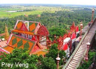
Prey Veng is quite a sleepy Cambodian province, that just happen to have one of the countries busiest highways running straight through it-National Highway No 1, which links Phnom Penh and Ho Chi Minh City in Vietnam. It is a small but heavily populated agricultural region located on the east banks of the mighty Mekong. The name of the province means literally tall forest, but actually doesn't refer in any case to lush forests as most of them were chopped down in the past 30-50 years. Also rubber played once a big economical role in this province, but since the war took over the country the plantations are no longer commercially viable.
There are little places of significance to see nowadays, but during the pre-Angkorian times it must have been one of the most populated and lively areas of the country. One of the earliest pre-Angkorian kingdoms was located in the area around Ba Phnom.

The sleepy provincial capital is also named Prey Veng and situates on the National Highway No 11, recently rebuild as a road link between National Road No 11 and No 7, or Neak Luong and Kompong Cham. There aren't a lot of travellers making their way to that small town. So if you would like to escape from your fellow travellers that's an opportunity, especially on the way to Kampong Cham. It's also a stop worth on the way to or from Vietnam. The town itself hosts a few decaying colonial buildings, showing that this was once a lively and important centre. There is a huge lake on the west edge of the town, which evaporates from March till August and local farmers cultivate their rice on the fertile ground.
Geography

Prey Veng province is 4,883 square kilometres big. It's located in the South of the country and is bordering to the North with Kampong Cham, to the West with Kandal, to the East with Svay Rieng and to the South with Vietnam. The province consists of the typical plain wet area for Cambodia, covering rice fields and other agricultural plantations (rubber plantations in former times). The province also features two of the biggest rivers of the country the Tonle Bassac and the mighty Mekong.

Population

The current population in this province is 1,063,494 person or 7.64% of the total population (14,363,519 person in Cambodia, 2007, provincial government data) with a growth rate of 2.40%, which consists of 502,671 person or 47.18% who are male and 560,823 person or 52.82% who are female. The above number also consists of 825,818 persons or 80.54% who are farmers, 140,685 persons or 13.72% who are fishermen, 44,561 persons or 4,35% who are traders and 14,267 persons or 1.39% who are government?s officers. The population density is 217.8 people per square kilometre.

Climate

The country has a tropical climate - warm and humid. In the monsoon season, abundant rain allows for the cultivation of a wide variety of crops. This year-round tropical climate makes Cambodia ideal for developing tourism. Travellers need not to fear natural disasters such as erupting volcanoes or earthquakes, and the country is not directly affected by tropical storms.

Climate: Cambodia can be visited throughout the year. However, those plans to travel extensively by road should be avoided the last two months of the rainy season when some countryside roads may be impassable. The average temperature is about 27 degrees Celsius; the minimum temperature is about 16 degrees. December and January are the coolest months, whereas the hottest is April.

General information about the provincial climate:

- Cool season: November- March (24-32c)
- Hot season: March- May (28c -36c)
- Rainy season: May - October (24-32c, with humidity up to 90%.)

Economy

Prey Veng's economy consists basically of agricultural farming, fishery, rice and fruit cropping and some garment factories producing for international markets. Especially the rural households depend on agriculture and its related sub-sectors.

Pailin Province

General Information

Pailin is a small municipality in the West of Cambodia very closed to the border of Thailand. The provincial capital is called Pailin City and is known to much of the world as being the area where many of the Khmer Rouge leaders came from and retreated after their fall. Until the year of 2001 Pailin was part of the Battambang Province, but was then elevated to city status and thus became a province and autonomous zone of its own.
The city was during the 1980s and 1990s a major Khmer Rouge strongpoint and resource centre. Even after the death of their brutal leader Pol Pot in 1998, many Khmer Rouge leaders still remained there. Some of the leaders went into hiding in fear of punishment for their crimes, although other leaders or henchmen lived openly in the province. It is said that almost 70 percent of the area's older men were fighters for the Khmer Rouge, but unfortunately none of the regular fighters have yet been brought to justice.

As of September 2007, Pailin's remaining Khmer Rouge leaders were being rounded up to face justice by an international tribunal, including Khieu Samphan and Nuon Chea. So after years of the governmental dump contemplation regarding the crime of the Khmer Rouge, its time for lasting enlightenment of what has happen.

Poipet is now more and more becoming a boomtown attracting Cambodians from around the country seeking to make their fortune, or at least a better salary than back home. Pailin was the major revenue producer for the Khmer Rouge guerrillas, being a major gem producing area as well as a prime logging area.

While gem production seems to have tapered off a bit, other business opportunities and the lifestyle have attracted prospectors to the town. Up until the surrender deal of Khmer Rouge's number three men, Ieng Sary, in 1996, the townsfolk lived under the strict rules of the KR hierarchy, with little freedom of expression and most aspects of life being completely controlled by the paranoid regime.

Pailin is just another Wild West town of Cambodia and like the gold-rush days of California, people seem to be everywhere in the hills sifting through mud puddles and scratching at the dirt, looking to strike it rich with the find of a nice gem. Still, there is more control of some aspects of life than in other areas of Cambodia.

But this seems to have attracted people rather than kept them away. Several people, who had moved to Pailin from Phnom Penh, gave this as the main reason they made the move. They liked the idea that criminals did not enjoy the same impunity that they seem to enjoy in Phnom Penh. The influx of residents from other parts of the country has produced a friendlier Pailin. Nowadays the mixed lot of Pailin residents seem happy to see foreigners coming in for holidays and check the place out, realizing that their presence means that normalcy and revenue are arriving in Pailin.

Even the Vietnamese residents seem to have been accepted, which is truly amazing given the hatred the Khmer Rouge have generally shown them. Pailin is worth checking out. The town is nestled in a beautiful valley with picturesque sunsets over the mountains that separate Cambodia and Thailand close by.

Wat Gohng-Kahng is very famous and features the much-photographed landmark gate of Pailin town that you face as you arrive on the highway from Battambang. This wat is the centre of holiday festivities these days in Pailin and was the scene of the official Pailin reintegration ceremony in 1996, after the Ieng Sary faction of the Khmer Rouge worked out surrender and semi-autonomy deals with the Cambodian government.
Geography

Pailin City municipality is the second smallest so-called province in Cambodia with 803 square kilometres. It's located in the West of the country surrounded by Battambang province and bordering Thailand to the West. In the North, the small municipality consists of the typical plain wet area for Cambodia, covering rice fields and other agricultural plantations.

Pailin City itself is located on the foothills of Chuor Phnom Kravanh, an extension of the Kardamom Mountains, which range until here. The South of the municipality is quite hilly and tops with the highest altitude of 1164m. The province also features some smaller rivers coming from the mountain range.
Population

The current population in this municipality is about 35,234 people or 0.25% of the country's total population (14,363,519 person in Cambodia, 2007, provincial government data), with 19,059 male and 16,175 female. The population density is therefore 44 people per square kilometre.

Climate

The country has a tropical climate - warm and humid. In the monsoon season, abundant rain allows for the cultivation of a wide variety of crops. This year-round tropical climate makes Cambodia ideal for developing tourism. Travellers need not to fear natural disasters such as erupting volcanoes or earthquakes, and the country is not directly affected by tropical storms.

Climate: Cambodia can be visited throughout the year. However, those plans to travel extensively by road should be avoided the last two months of the rainy season when some countryside roads may be impassable. The average temperature is about 27 degrees Celsius; the minimum temperature is about 16 degrees. December and January are the coolest months, whereas the hottest is April.

General information about the provincial climate:
- Cool season: November- March (22-28c)
- Hot season: March- May (27c -34c)
- Rainy season: May - October (24-32c, with humidity up to 90%.)
Economy

The surrounding area of Pailin City was rich in a variety of gemstones which were mined almost clean to support the Khmer Rouge. They also logged the area to create personal wealth with no regard for the effect on the environment. Nowadays all you can find is low-quality, cheap, hand-faceted gemstones at the market in Pailin downtown.

After the exploitation of the natural resources available, the Khmer Rouge invested their money in the Casinos around Pailin. Pailin is located in the most heavily mined area in the world, so especially unaware travellers are cautioned to stay only on marked roads.
Citizens of Pailin will accept Baht, Riels and US dollars, though US dollars are preferred.

Oddor Meanchey Province

General Information

Oddar Meanchey is one of the smallest provinces of Cambodia located in the far Northwest bordering with Thailand. Its name means Victory Province and the provincial capital is called Samraong. This area was formerly known as Phanomsok, a province of Thailand, which was ceded to French Indochina in 1906, and now remains a part of Cambodia. This province is also a recent creation that was carved out of Siem Reap Province, which the government did not control for much of the 1980s and 1990s.
The countryside is covered by the Dangrek Mountains (or escarpment, as they are sometimes called), which was an optimal shelter for the Khmer Rouge to hide. It is a very remote province that has been a notorious place, because this is where he nastiest of the nasty Khmer Rouge made their last stand. The diabolical Pol Pot and his seemingly bloodthirsty henchmen, Nuon Chea, Ta Mok, Son Sen and Khieu Samphan holed up here for the last years of the Khmer Rouge's existence (another of the henchmen, Ieng Sary, already worked out a surrender and defection deal with the government in 1996).

Pol Pot died mysteriously here, after a supposed power struggle within the power elite (he had Son Sen and his family murdered) and after a controversial show trial. The debate focused on whether it was real or just a sham staged for the outside world to try to legitimize remaining Khmer Rouge figures. The trial took place in the power centre of the Khmer Rouge, the village of Anlong Veng. Pol Pot died mysteriously after he was sentenced to house arrest and the international community began real efforts (for the first time ever) to capture and put this butcher on trial.

His henchmen had more than enough reasons to believe that he wasn't dead at that point, because a Pol Pot on trial, as the ringleader most responsible for the genocide wrought upon his fellow countrymen, would probably have tried to shift portions of the blame (rightfully in the case of these guys) to the rest of the power elite.

The Khmer Rouge kept fragmenting after that and Nuon Chea and Khieu Samphan worked out a surrender-amnesty deal with the Cambodian government and Ta Mok (also called The Butcher) was subsequently captured and is still awaiting a trial in Phnom Penh. As of March 2000, the United Nations and the Cambodian government finally seem set to come up with an agreement on putting the top surviving members of the Khmer Rouge regime on trial in Cambodia, with assistance from and in a partnership with the International Community. Stay tuned though, as this has been a real political football with seemingly more concern for one-upsmanship and personal gain than justice for the dead and surviving victims of Khmer Rouge brutality.

The international border is 14.5 km from the circle in Anlong Veng (Anlong Veng-Choam-Choam- Srawngam and O Smach-Chong Jom). There are plenty of tanks and tank shells to look at along the way and also a strange site in the form of a boulder that had Khmer Rouge soldiers carved out of the sides of it- they have all been decapitated since government forces took control of Anlong Veng. Anyway, it's an interesting little ride to a low-lying part of the Dangkrek Mountains. The road is in fairly good shape with the exception of the climb up a rocky hillside near the border.
Geography

Oddor Meanchey province is 6,158 square kilometres big. It's located in the far Northwest of the country and is bordering to the North with a lengthy borderline to Thailand, to the East with Preah Vihear, to the West with Banteay Meanchey and Siem Reap to the South. In the North the province consists of the re-known Dangkrek Mountains, which are more or less the hill foods of the massive mountain range (the real Dangkrek Mountains) coming from Thailand. There is a nice interesting wildlife sanctuary called Kulen Promtep in the Southeast of the province. The rest of the province is an agricultural used strip, where the illegal logging of the 1980s and 1990s shows its rampant face.
Population

The current population in this province is about 102,835 people or 0,7% of the country?s total population (14,363,519 person in Cambodia, 2007, provincial government data), with 52,650 male and 50,185 female. The population density is therefore 16,7 people per square kilometre.
Climate

The country has a tropical climate - warm and humid. In the monsoon season, abundant rain allows for the cultivation of a wide variety of crops. This year-round tropical climate makes Cambodia ideal for developing tourism. Travellers need not to fear natural disasters such as erupting volcanoes or earthquakes, and the country is not directly affected by tropical storms.

Climate: Cambodia can be visited throughout the year. However, those plans to travel extensively by road should be avoided the last two months of the rainy season when some countryside roads may be impassable. The average temperature is about 27 degrees Celsius; the minimum temperature is about 16 degrees. December and January are the coolest months, whereas the hottest is April.

General information about the provincial climate:
- Cool season: November- March (22c-28c)
- Hot season: March- May (27c -35c)
- Rainy season: May - October (24c-32c, with humidity up to 90%.)
Economy

The province's economy is 93% based on farming and the remaining other 7% are based on fishing and trading. Because of its border with Thailand, the international trade is also booming and becoming another important sector of the province's economy. There is several developing plans from province based NGO's, the Ministry of Foreign Affairs from Thailand and Cambodian government itself. The economy and infrastructure of the province was sustainably destructed during the Khmer Rouge stand and needs therefore a whole new stabile backbone.