Thursday, February 25, 2016

Tonle Sap Lake

Tonle Sap Lake is the largest lake in Asia and one of the most important biodiversity sites in the world.  At its height, the ancient Angkor Kingdom used its riches to support the largest human population on the planet in its day.  Centuries later, the Khmer people still rely on Tonle Sap for food as well as for trade.
During the rainy season, tributary rivers reverse their flow and swell the lake to ten times its dry season size.  This is a unique occurence.  It does not happen in any other water system in the world. 
Life around Tonle Sap Lake is a major source of Cambodian culture.  Tourists can enjoy unparalleled access to exotic bird watching, riverboad culture, and Khmer culinary traditions.  No trip to Cambodia is complete without a visit to this fantastic natural and cultural treasure.
Cruise on the Tonle Sap Lake is an opportunity to meet the people who make their living and build their homes on the lake.  The fascinating lifestyle here includes subsistence and commercial fishing, crocodile breeding, and handicraft construction for the markets of Siem Reap. 
Travel to the Prek Toal Biosphere Bird Sanctuary and Floating Village
Prek Toal is a magnificent floating village and the access point for the Biosphere Bird Sanctuary, the home of many rare and endangered birds including Big Marabouts, pelicans, and storks.    The trip from Siem Reap is two hours and we sail through the many floating villages on the lake On the way,

We stop at the Floating Forest, a long strand of tropical jungle that floods every year, making for a beautiful and sometimes spooky landscape. A picnic lunch is included in this day-long trip. Entrance Fees for visit : USD $25 per person.
Visit Kompong Phluk: This full-day trip takes you into the heart of mangrove forests on the margins of the Tonle Sap Lake to the incredible stilt villages of Kompong Phluk and Kompong Khleang.
This trip includes a tour of the Floating Forest as well as a visit to an amazing floating pagoda.You will experience the traditional and peacefull life of the fishing communities here. If water levels are low, we can take a canoe ride deep into the mangrove forests, where few foreigners travel.
Shop Siem Reap Town: at Phsar Chas (Old Market), travelers can catch glimpses of Khmer market life, a foundation of life in Cambodia, as well as see and purchase souvenirs.  Most Khmer buy their groceries from market vendors and the intrepid foreigner can experience the sights and smells of life in Cambodian homes.
There are also many souvenirs to buy before your trip home.The Central Market and Siem Reap's multiple night markets are also worth exploring.  Handicrafts, textiles, and jewelry is for sale here, and a Khmer guide is very useful in bargaining for the best prices and pointing out hidden treasures that may catch your eye.  
Many inexpensive and delicious Khmer restaurants are in this area as well, making for an excellent place to spend a few hours.

Learning a Lost Art in Siem Reap/Angkor Wat

Cambodia has a rich and varied musical tradition.  Though much of that tradition was lost in our civil war, those masters of our native instruments who survived are now passing on their expertise to the younger generation.  I am very lucky that some of these musical elders live and practice their art in my home village. And I am very pleased that I can offer my guests the opportunity to learn some of this art themselves.
Plengkah style is the traditional Khmer wedding and party music.  Palm Tree Village's plengkah band includes Mr. Ouk on trosaw, a unique two-stringed instrument played with a bow, Mr. Thow on dakay, a hollow wooden instrument similar to the West's dulcimer, and Mr. Tat on drums.
Pinpeat style is the traditional music used at Buddhist festivals, funerals, and apsara performances.  Our band includes Mr. Chen on the roneat, our version of the Western marimba, Mr. Lin on the sralai, a woodwind with a quadruple reed, Mr. Hoch on sampoa, a native drum, and Mr. Oll on the gong thom, a circular rack of miniature gongs played with mallets. I offer day-long musical excursions to Palm Tree village where guests can enjoy live performances of both types of music,
learn about Khmer instruments and musical traditions, and try their hand at the instruments themselves.  Some of these instruments are sold in Siem Reap's markets, and guests can use their new skills to entertain friends and family back home.
Longer musical homestays are also available for those seeking a more in-depth learning experience.  Please contact me to discuss the curriculum. Don't miss this once in a lifetime chance to study with Cambodia's musical masters.

Phnom Penh City

Phnom Penh city takes the name form the present Wat Phnom or Hill temple.Legend has it that in 1372 ,an old nun named Penh went to fetch the water in the Mekong river and found a dead koki tree floating down the stream .Inside the hole of the dead koki tree contained four bronze and one stone Buddha statues in it .Daun (Gandma) Penh brought the statues ashore and ordered people to pile up earth at northeast of her house and used those Koki trunks to build a temple on 
that hill to house the five Buddha statues, then named the temple after her as Wat Phnom Daun Penh, which presently known as Wat Phnom, a small hill of 27 metres (89 ft) in height.The city was originally called Phnom Daun Penh after it was founded, but it was later abbreviated to just Phnom Penh.
The city was also previously known as Krong Chaktomuk meaning "City of Four Faces". This name refers to the junction where the Mekong, Bassac, and Tonle Sap rivers cross to form an "X" where the capital is situated. Phnom Penh the Royal capital of Cambodia.
Phnom Penh first became the royal capital of Cambodia in 1432 after His Majesty Ponhea Yat (b.1421,r.1432-1462), king of the Khmer Empire, moved the capital from Toul Bassan (presently called Srey Santhor) at Angkor Thom after it was captured by Siam a few years earlier. There are stupa behind Wat Phnom that house the remains of Ponhea Yat and the royal family as well as the remaining Buddhist statues from the Angkorean era.
Phnom Penh remained the royal capital for 73 years from 1432 to 1505 when it was abandoned for 360 years from 1505 to 1865 by subsequent kings due to internal fighting between the royal pretenders. Later kings moved the capital several times and established their royal capitals at various locations in Tuol Basan (Srey Santhor), Pursat, Longvek, Lavear Em and Oudong.
According to the historical records, in the 1600s, many Japanese immigrants had settled on the outskirts of Phnom Penh.But it was not until 1865 that Phnom Penh became the permanent royal capital of Cambodia when King Norodom I, great grandfather of Norodom Sihanouk,
ordered 10,000 of his subjects to move out of the old royal capital of Oudong and settled in.Phnom Penh and the current Royal Palace was built in 1866 under the supervision of Oknha Tep Nimitr Mak.
Phnom Penh during H. M. King Norodom’s Reign: (1860), (r.1865-1904)Phnom Penh during the first ten years of king Norodom’s reign was little more than a village with few huts lining the river. when Phnom Penh was re-established in 1865, it was divided into 3 villages: a Catholic
Village located to the north of the city in the Russey Keo vicinity which was populated by the Vietnamese Catholic faithful. A Chen (Chinese) Village located in the middle of the city along Sap river which was populated by Chinese traders. A Khmer Village located to the south of the city, around the present royal palace and Wat Unalaom for Khmer population.
Beginning in 1870, the French colonial administration had turned a sleepy village into a city when it started to build hotels, schools, prisons, barracks, bank, public works offices, telegraph offices, Law courts, and health services buildings. In 1872, the first glimpse of a modern city took shape when the colonial administration contracted a French contractor, Le Faucheur, to construct the first 300 concrete houses for sales and rentals to the Chinese traders.
In 1884, the colonial administrator commissioned the constructions of underground sewage systems, canals to control the wetlands and roads, buildings and a port were also constructed..in 1893, Wat Phnom park had been rehabilitated and a zoo was built, surrounded by gardens. A construction of Boulevard Doubart de Lagrée, presently renamed Blvd. 
Preah Norodom had also begun. In 1895, CEEL, the first French company that produced clean water for Phnom Penh, built its first water plant at Chroy Changva. in 1897, the population of Phnom Penh city was close to 50,000 people out of a total population of the whole country of more than a 1,000,000. The population of Phnom Penh consisted of many ethnic groups such as the Chinese (22,000), Khmers (16,000), Vietnamese (4,000) and the French residents who were only numbered at about 400 people.
Besides above ethnic groups, there were Malaysians, Thais, Indians, Laotians and others who called Phnom Penh their homes.Phnom Penh during the reign of H.M. King Sisowath: 1904-1927
There are not much records about the developments of Phnom Penh City during the reign of King Sisowath, except that the colonial administration had contracted the dredging of the Mekong and Sap rivers in order to facilitate marine navigation to enable ships and naval vessels to reach Phnom Penh. The records show that in 1914 the colonial administration had begun to expand the city to the west and to the south until Bassac river.
Phnom Penh during H.M. King Monivong’s Reign:1927-1941
King Monivong’s reign was a period that Cambodia had first begun a policy of constructions. In 1928, a French company, Grands Travaux de Marseille (GTM), had been contracted to begin pumping sands from the bottom of Tonle Sap River to fill up Decho lake and other lakes in the city. The year of 1929 also seen a construction of a steel Preah Monivong Bridge. In 1932, the first railway tracts and stations from Phnom Penh to Battambang had been commissioned. The Boulevard Miche, now renamed Blvd.Preah Monivong had also been constructed.
In 1935, the Grand Market, now called Phsar Thom Thmey Market, was built. And in 1939, Verdun Avenue, now renamed Blvd. J. Nerhu and Ave. Preah Sihanouk was built.in 1939, the population of Phnom Penh City was about 108,000 people, and the population of the whole of Cambodia was about 3,000,000 people. Phnom Penh during the reign of H.M.
King and Prince Norodom Sihanouk : 1941-1970 and 1993-2004.Phnom Penh under the period of Sihanouk’s rule had seen the expansion and the constructions of many modern infrastructures. The City’s population had also grown dramatically. The city’s population had grown to 111,000 in 1942. By 1950 it had grown to 354,000 and 355,000 in 1958. By 1962, the population of Phnom Penh City reached 394,000. The city had been expanded and many infrastructures had been built. In 1958, the Blvd. Mao Tse Tung was constructed. And in 1961, the city had expanded and Tuol Kork, a new flashy modern suburb, was constructed. Other infrastructures had also been built during this period.
The International Olympic Stadium was built in 1963. In 1964, Tonle Bassac Theater and a Casino, now renamed the Cambodiana Sofitel Hotel, were constructed. A railway line from Phnom Penh to Kompong Som (Sihanoukville) was also commissioned in 1964. And the International Airport of Pochentong was also built. And in 1966, 
the Sangkum Reah Niyum Bridge, now renamed the Cambodia-Japan Friendship Bridge, was built with funds provided by Japan. Many tertiary institutions such as the Sangkum Reastr Niyum University, The Khmer-Soviet Institute of Technology, Royal Phnom Penh University, The Khmer-Soviet Institute of Technology, Royal Phnom Penh University, the Institute of Foreign Languages and many more were constructed during this period. Gardens and parks were constructed and beautified. Phnom Penh City in the 1960s was called the Pearl of Asia.
Phnom Penh during the Khmer Republic of Marshall Lon Nol: 1970-1975
Phnom Penh from 1970 onward had not seen much developments due to the Cambodian civil war. The original population of Phnom Penh City of 900,000 had swelled to over 2,000,000 at the end of the war in 1975 because of war refugees from the countryside.On the contrary, many infrastructures had been destroyed by fighting and shells. In 1973,
the Khmer Rouge mined Chroy Changvar Bridge two times which eventually destroyed it.Phnom Penh during the Khmer Rouge Reign of Terror: 1975-1979
The Khmer Rouge took power on 17th April 1975 and immediately began to evacuate whole population out of the city.
In three days, a city with a population of 2,000,000 had been reduced to a population of a few Khmer Rougeofficials. Many infrastructures and buildings and part of the city had been significantly destroyed.
After the Vietnamese troops toppled the Khmer Rouge on 5th January 1979, the population began to return to Phnom Penh. As of 1998,
The population of Phnom Penh City had numbered to 862,000 people, including 149,000 families. In 2009, the population of Phnom Penh is estimated to number more than a million out of a total country’s population of approximately 14,000,000.

Cambodia History


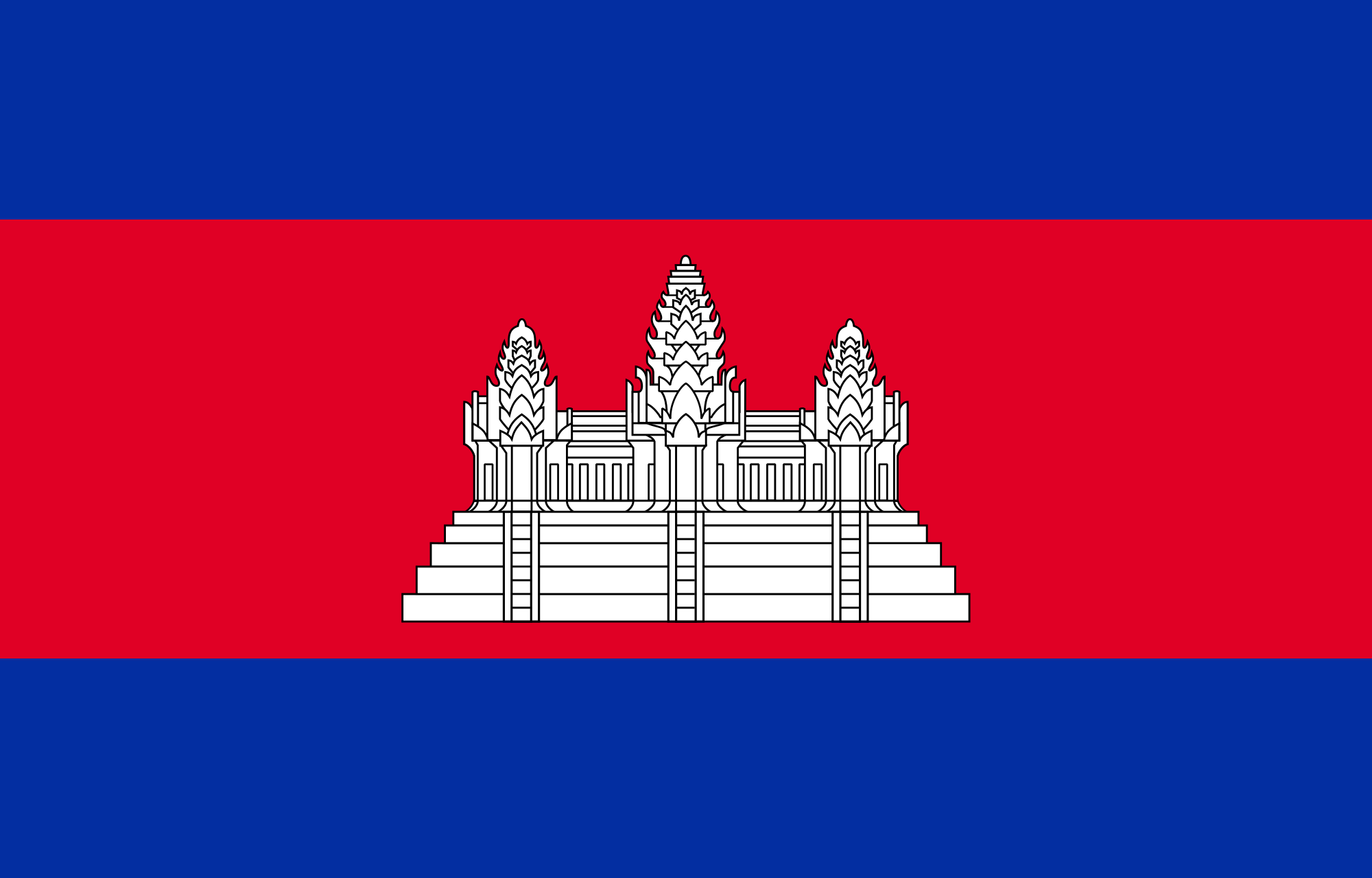
The good, the bad and the ugly is the simple way to sum up Cambodian history. Things were good in the early years, culminating in the vast Angkor empire, unrivalled in the region during four centuries of dominance. Then the bad set in, from the 13th century, as ascendant neighbors steadily chipped away at Cambodian territory. In the 20th century it turned downright ugly, as a brutal civil war lead to the genocidal rule of the Khmer Rouge (1975 – 1979), from which Cambodia is still recovering.

Early:
Cambodia came into being, so the story goes, through the union of a princess and a foreigner. The foreigner was an Indian Brahman named Kaundinya and the princess was the daughter of a dragon king who ruled over a watery land. One day, as Kaundinya sailed by the princess paddled out in a boat to greet him. Kaundinya shot and arrow from his magic bow into her boat, causing the fearful princess to agree to marriage. In need of a dowry, her father drank up the waters of his land and presented them to Kaundinya to rule over. The new kingdom was named Kambuja.
Like many legends, this one is historically opaque, but it does say something about the cultural forces that brought Cambodia into existence; in particular its relationship with its great sub continental neighbors, India. Cambodia’s religious, royal and written traditions stemmed from India and began to coalesce as a cultural entity in their own right between the 1st and 5 th centuries.
Very little is known about prehistoric Cambodia. Much of the southeast was a vast, shallow gulf that was progressively silted up by the mouths of the Mekong, leaving pancake-flat, mineral-rich land ideal for farming. Evidence of cave-dwellers has been found in the northwest of Cambodia. Carbon dating on ceramic pots found in the area shows that they were made around 4200BC, but it is hard to say whether there is a direct relationship between these cave-dwelling pot makers and contemporary Khmers. Examinations of bones dating back to around 1500 BC, however, suggest that the people living in Cambodia at that time resembled the Cambodians of today. Early Chinese records report that the Cambodians were 'ugly' and 'dark' and went about naked; but a pinch of salt is always required when reading the culturally chauvinistic reports of imperial China concerning its ‘barbarian’ neighbors.

Indianisation and Funan:

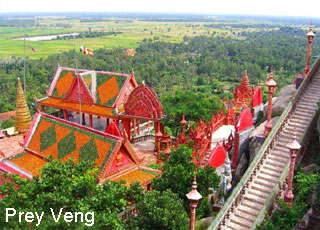
The early Indianisation of Cambodia occurred via trading settlements that sprang up from the 1st century on the coastline of what is now southern Vietnam, but was then inhabited by Cambodians. These settlements were ports of call for boats following the trading route from the Bay of Bengal to the southern provinces of China. The largest of these nascent kingdoms was known as Funan by the Chinese, and may have existed across an area between Ba Phnom in Prey Veng Province, a site only worth visiting for the archaeologically obsessed today, and Oc-Eo in Kien Giang Province in southern Vietnam. It would have been a contemporary of Champasak in southern Laos (then known as Kuruksetra) and other lesser fiefdoms in the region.
Funan is a Chinese name, and it may be a transliteration of the ancient Khmer word bnam (mountain). Although very little is known about Funan, much has been made of its importance as an early Southeast Asian centre of power.
It is most likely that between the 1st and 8th centuries, Cambodia was a collection of small states, each with its won elites that often strategically intermarried and often went to war with one another. Funan was no doubt one of these states, and as a major sea port would have been pivotal in the transmission of Indian culture into the interior of Cambodia.
What historians do know about Funan they have mostly gleaned from Chinese sources. These report that Funan-period Cambodia (1st to 6th centuries AD) embraced the worship of the Hindu deities Shiva and Vishnu and, at the same time, Buddhism. The linga (phallic totem) appears to have been the focus of ritual and an emblem of kingly might, a feature that was to evolve further in the Angkorian cult of the god-king. The people practiced primitive irrigation, which enabled the cultivation of rice, and traded raw commodities such as spices with China and India.

Chenla Period:

From the 6th century the Funan kingdom’s importance as a port of call declined, and Cambodia’s population gradually concentrated along the Mekong and Tonlé Sap Rivers, where the majority remains today. The move may have been related to the development of we-rice agriculture. From the 6th to 8th centuries it was likely that Cambodia was a collection of competing kingdoms, ruled by autocratic kings who legitimized their absolute rule through hierarchical caste concepts borrowed from India.
This era is generally referred to as the Chenla period. Again, like Funan, it is a Chinese term and there is little to support the idea that the Chenla was a unified kingdom that held sway over all of Cambodia. Indeed, the Chinese themselves referred to ‘water Chenla’ and ‘land Chenla’. Water Chenla was located around Angkor Borei and the temple mount of Phnom Da, near the present-day provincial capital of Takeo, and land Chenla in the upper reaches of the Mekong River and east of the Tonlé Sap lake, around Sambor Prei Kuk, an essential stop on a chronological jaunt through Cambodia’s history.
The people of Cambodia were well known to the Chinese, and gradually the region was becoming more cohesive. Before long the fractured kingdoms of Cambodia would merge to become the greatest empire in Southeast Asia.

Angkor Period:

A popular place of pilgrimage for Khmers today, the sacred mountain of Phnom Kulen, to the northeast of Angkor, is home to an inscription that tells us in 802 Jayavarman II proclaimed himself a ‘universal monarch’, or devaraja (god-king). It is believed that he may have resided in the Buddhist Shailendras’court in Java and a young man. One of the first things he did when he returned to Cambodia was to reject Javanese control over the southern lands of Cambodia. Jayavarman II then set out to bring the country under his control through alliances and conquests, the first monarch to rule and of what we call Cambodia today.
Jayavarman II was the first of a long succession of kings who presided over the rise and fall of the Southeast Asian empire that was to leave the stunning legacy of Angkor. The first records of the massive irrigation works that supported the population of Angkor date to the reign of Indravarman I (877-89). His rule also marks the beginning of Angkorian art, with the building of temples in the Roluos area, notably the Bakong. His son Yasovarman I (889-910) moved the royal court to Angkor proper, establishing a temple-mountain on the summit of Phnom Bakheng.
By the turn of the 11th century the kingdom of Angkor was losing control of its territories. Suryavarman I (1002-49), a usurper, moved into the power vacuum and, like Javavarman II two centuries before, reunified the kingdom through war and alliances. He annexed the Dravati kingdom of Lopburi in Thailand and widened his control of Cambodia, stretching the empire to perhaps its greatest extent. A pattern was beginning to emerge, and can be seen throughout the Angkorian period: dislocation and turmoil, followed by reunification and further expansion under a powerful king. Architecturally, the most productive periods occurred after times of turmoil, indicating that newly incumbent monarchs felt the need to celebrate and perhaps legitimize their rule with massive building projects.
By 1066 Angkor was again riven by conflict, becoming the focus of rival bids for power. It was not until the accession of Suryavarman II (in 1112) that the kingdom was again unified. Suryavarman II embarked on another phase of expansion, waging wars in Vietnam and the region of central Vietnam known as Champa. He also established links with China. But Suryavarman II is immortalized as the king who, in his devotion to the Hindu deity Vishnu, commissioned the majestic temple of Angkor Wat.
Suryavarman II had brought Champa to heel and reduced it to vassal status. In 1177, however, the Chams struck back with a naval expedition up the Mekong and into Tonlé Sap Lake. They took the city of Angkor by surprise and put King Dharanindravarman II to death. The next year a cousin of Suryavarman II gathered forces and defeated the Chams in another naval battle. The new leader was crowned Jayavarman VII in 1181.
A devout follower of Mahayana Buddhism, Jayavarman VII built the city of Angkor Thom and many other massive monuments. Indeed, many of the monuments visited by tourists around Angkor today were constructed during Jayavarman VII’s reign. However, Jayavarman VII is a figure of many contradictions. The bas-reliefs of the Bayon depict him presiding over battles of terrible ferocity, while statues of the king show him in a meditative, otherworldly aspect. His program of temple construction and other public works was carried out in great haste, no doubt bringing enormous hardship to the laborers who provided the muscle, and thus accelerating the decline of the empire. He was partly driven by a desire to legitimize his rule, as there may have been other contenders closer to the royal bloodline, and partly by the need to introduce a new religion to a population predominantly Hindu in faith.

Decline and Fall:

Some scholars maintain that decline was hovering in the wings at the time Angkor Wat was built, when the Angkorian empire was at the height of its remarkable productivity. There are indications that the irrigation network was overworked and slowly starting to silt up due to the massive deforestations that had taken place in the heavily populated areas to the north and east of Angkor. Massive construction projects such as Angkor Wat and Angkor Thom no doubt put an enormous strain on the royal coffers and on thousands of slaves and common people who subsidized them in hard work and taxes. Following the reign of Jayavarman VII, temple construction effectively ground to a halt, in large part because Jayavarman VII’s public works quarried local sandstone into oblivion and the population was exhausted.
Another important aspect of this period was the decline of Cambodian political influence on the peripheries of its empire. At the same time, the Thais were ascendant, having migrated south from Yunnan to escape Kublai Khan and his Mongol hordes. The Thais, first from Sukothai, later Ayuthaya, grew in strength and made repeated incursions into Angkor, finally sacking the city in 1431 and making off with thousands of intellectuals, artisans and dancers from the royal court. During this period, perhaps drawn by the opportunities for sea trade with China and fearful of the increasingly bellicose Thais, the Khmer elite began to migrate to the Phnom Penh area. The capital shifted several times in the 16th century but eventually settled in present day Phnom Penh.

The Dark Ages:

From 1600 until the arrival of the French in 1863, Cambodia was ruled by a series of weak kings who, because of continual challenges by dissident members of the royal family, were forced to seek the protection-granted, of course, at a price-of either Thailand or Vietnam. In the 17th century, assistance from the Nguyen lords of southern Vietnam was given on the proviso that Vietnamese be allowed to settle in what is now the Mekong Delta region of Vietnam, at that time part of Cambodia and today still referred to by the Khmers as Kampuchea Krom (Lower Cambodia).
In the west, the Thais controlled the provinces of Battambang and Siem Reap from 1794; by the late 18th century they had firm control of the Cambodian royal family. Indeed, one king was crowned in Bangkok and placed on the throne at Udong with the help of the Thai army. That Cambodia survived through the 18th century as a distinct entity is due to the preoccupations of its neighbors: while the Thais were expending their energy and resources in fighting the Burmese, the Vietnamese were wholly absorbed by internal strife.

French Rule:

Cambodia’s long period of bouncing back and forth between Thai and Vietnamese masters ended in 1864, when French gunboats intimidated King Norodom I (1860-1904) into signing a treaty of protectorate. French control of Cambodia, which developed as a sideshow to French-colonial interests in Vietnam, initially involved little direct interference in Cambodia’s affairs. More importantly, the French presence prevented Cambodia’s expansionist neighbors from annexing any more Khmer territory and helped keep Norodom on the throne despite the ambitions of his rebellious half-brothers.
By the 1870s French officials in Cambodia began pressing for greater control over internal affairs. In 1884, Norodom was forced into signing a treaty that turned his country into a virtual colony. This sparked a two-year rebellion that constituted the only major anti-French movement in Cambodia until after WWII. This uprising ended when the king was persuaded to call upon the rebel fighters to lay down their weapons in exchange for a return to the pre-treaty arrangement.
During the next two decades senior Cambodian officials, who saw certain advantages in acquiescing to French power, opened the door to direct French control over the day-today administration of the country. At the same time the French maintained Norodom’s court in a splendor unseen since the heyday of Angkor, thereby greatly enhancing the symbolic position of the monarchy. The French were able to pressure Thailand into returning the northwest provinces of Battambang, Siem Reap and Sisophon in 1907, in return for concessions of Lao territory to the Thais, returning Angkor to Cambodian control for the first time in more than a century.
King Norodom I was succeeded by King Sisowath (1904-27), who was succeeded by King Monivong (1927-41). Upon King Monivong’s death, the French governor general of Japanese-occupied Indochina, Admiral Jean Decoux, placed 19-year-old Prince Norodom Sihanouk on the Cambodian throne. Sihanouk would prove pliable, so the assumption went, but this proved to be a major miscalculation.
During WWII, Japanese forces occupied much of Asia, and Cambodia was no exception. However, with many in France collaboration with the occupying Germans, the Japanese were happy to let these French allies control affairs in Cambodia. The price was conceding to Thailand (a Japanese ally of sorts) much of Battambang and Siem Reap Provinces once again, areas that weren’t returned until 1947. However, with the fall of Paris in 1944 and French policy in disarray, the Japanese were forced to take direct control of the territory by early 1945. After WWII, the French returned, making Cambodia an autonomous state within the French Union, but retaining de facto control. The French deserved independence it seemed, but not its colonies. The immediate postwar years were marked by strife among the country’s various political factions, a situation made more unstable by the Franco-Viet Minh War then raging in Vietnam and Laos, which spilled over into Cambodia. The Vietnamese, as they were also to do 20 years later in the war against Lon Nol and the Americans, trained and fought with bands of Khmer Issarak (Free Khmer) against the French authorities.

Modern History

By 1953 a strong local leader, King Sihanouk, had risen to power with the Khmer and sought independence for his country. King Sihanouk was a masterful politician and succeeded in wringing form the French the independence of Cambodia. King Sihanouk also established the People’s Socialist Communist Party at this time. After abdicating the throne to pursue a political career, Sihanouk became the country’s first prime minister. He managed to keep Cambodia neutral in the Vietnam War until 1965, when he broke with the United States and allowed North Vietnam and the Vietcong to use Cambodian territory. This led to the bombing of Cambodia by United States forces.

Sihanouk was deposed by one of his generals in 1970 and fled the country to China, where he set up a government in exile that supported the Cambodian revolutionary movement known as the Khmer Rouge. Meanwhile, in Cambodia, United States and South Vietnamese forces invaded the country in an attempt to eliminate Vietcong forces hiding there. For the next five years, as savage fighting spread throughout Cambodia, the Khmer Rouge gained land and power. In 1975 the capital at Phnom Penh fell to the Khmer Rouge, and their leader, Pol Pot, became the leader of Cambodia.

What followed for the next three years remains one of the most horrific incidents in world history. The Khmer Rouge forced the entire population of Phnom Penh and other cities to evacuate to the countryside where they were placed in slave labor units and forced to do manual work until they dropped from exhaustion. Pol Pot and his followers began a campaign of systematic genocide against their own people, with the aim of returning Cambodia to the agrarian society of centuries before. Great segments of the population were slaughtered senselessly. People with any type of education, those who wore glasses or were doctors and nurses, anybody who had worked at a bank—these people were all mindlessly killed. Banks were blown up, airports closed, and money was abolished. The horror of the Pol Pot regime went unnoticed for several years.

Finally in 1978, Vietnam, which had been watching the persecution and death of its own citizens trapped in Cambodia, liberated Cambodia and chased Pol Pot and his followers out of the cities and back into the remote mountains. By 1979, Pol Pot had been ousted and the Vietnamese installed a new government. Until 1990 civil war continued sporadically in Cambodia, but gradually the murderous followers of Pol Pot were eliminated from power. Pol Pot died under house arrest in 1998.

Throughout the 1990’s United Nations peacekeeping efforts helped stabilize the country. By 1997, a government amnesty convinced most Khmer Rouge partisans to cease fighting, and on October 4, 2004 the Cambodian National Assembly agreed with the U.N. to set up an international war crimes tribunal to try senior Khmer Rouge officials for the genocide of the 1970s. The first trial began in 2009 against the former head of S-21 prison; more leaders are expected to be tried over the next decade.

Another stabilizing influence during recent decades has been the return of the monarchy in 1993, when King Sihanouk was restored to the throne. In 2004, ill health forced him to abdicate in favor of his son, Norodom Sihamoni, who currently reigns as a constitutional monarchy.

Tuesday, January 26, 2016

Preah Vihear Province

General Information

Preah Vihear is quite a big northern province of Cambodia. Its capital is called Phnom Tbeng Meanchey. The province itself is named after the temple of Prasat Preah Vihear, what is definitely the hotspot of this province. Much of the province is extremely remote and strongly forested. Unfortunately do large logging companies reduce the natural landscape by carving huge tracts of pristine tropical hardwoods out of the locations. It is also one of the least populated provinces in the Kingdom of Cambodia. This tranquil site is popular for the Preah Vihear temple, standing in the vicinity of the borderline between Thailand and Cambodia.
The province has one of the worst infrastructures in the country there are even no proper Major Roads in existence. Going around this province is not that easy if you're used to proper roads and usual transportation possibilities, as there are only a few pick-ups or some money-hunting moto drivers to take you where you would like to go.

Whatsoever the province has a lot to offer for those, who are interested in ancient temple structures and remote villages without touristy influence. Here in Preah Vihear you may find three of the most impressive legacies from the Angkorian era: the mountain temple of Prasat Preah Vihear, the 10th-century capital of Koh Ker and the mighty Preak Khan.

Koh Ker is nowadays easily accessible from Siem Reap via Beng Mealea, but the other two still remain difficult to visit, requiring long and tough overland journeys and a distinct possibility to spend a night in the jungle. During the wet season these places are more or less unreachable. But there are governmental plans to develop the region for a smooth but constant tourism, building roads and improving infrastructure.

The provincial capital Tbeng Meanchey is due to the state of the infrastructure and it's geographical location not visited by a lot of foreigners. Most of them don't make it here worrying about the street conditions and the backcountry feeling of no fast supply in need. The city is sprawling and dusty and consists of little more than two small major dirt roads form South to North. There is nothing interesting in town or to do, so it has necessarily become more a stopover on the way to Koh Ker and Preah Khan.
Geography

Preah Vihear province is 13,788 square kilometres big. It's located in the North of the country and shares its international border to the North with Thailand and Laos, its provincial borders to the East with Stueng Treng, to the West with Oddar Meanchey and Siem Reap and to the South with Kompong Thom. The province is blessed with endless natural treasure. With its acres of dense, hilly forests and scrub green vegetation, Preah Vihear is indeed an ideal getaway destination in the lap of nature. The breathtaking views over the Dangkrek Mountains and lush jungle from Preah Vihear temples are famous.

Population

The current population in this province is about 160,551 people or 1.1% of the country's total population (14,363,519 person in Cambodia, 2007, provincial government data), with 81,318 male and 78,233 female. The population density is therefore 11.64 people per square kilometre.

Climate

The country has a tropical climate - warm and humid. In the monsoon season, abundant rain allows for the cultivation of a wide variety of crops. This year-round tropical climate makes Cambodia ideal for developing tourism. Travellers need not to fear natural disasters such as erupting volcanoes or earthquakes, and the country is not directly affected by tropical storms.

Climate: Cambodia can be visited throughout the year. However, those plans to travel extensively by road should be avoided the last two months of the rainy season when some countryside roads may be impassable. The average temperature is about 27 degrees Celsius; the minimum temperature is about 16 degrees. December and January are the coolest months, whereas the hottest is April.

General information about the provincial climate:
- Cool season: November- March (22-28c)
- Hot season: March- May (27c -35c)
- Rainy season: May - October (24-32c, with humidity up to 90%.)
Economy

The province's economy is 85% based on farming and the remaining other 15% are based on fishing and illegal trading with pristine hardwoods. Because of its border with Thailand, the international trade is also increasing slightly and becoming another important sector of the province's economy. There is several developing plans from province based NGO's, the Ministry of Foreign Affairs from Thailand and Cambodian government itself. The economy and infrastructure of the province was also sustainably destructed during the Khmer Rouge stand and needs therefore a whole new stabile backbone.

Takeo Province

General Information

Takeo province is often referred to as the cradle of Cambodian civilisation Takeo province has several important pre-Angkorian sites built between the 5th and the 8th century. The provincial capital, Takeo town is an easygoing place that possesses a fair amount of natural and manmade beauty. The natural beauty is in the Scenic River and lake area that faces a pleasant town parkway. The low-lying area seems to include much of the surrounding province area, which is probably why a kingdom that once had its heart here was referred to as Water Chenla. There seems to be water everywhere in the surrounding countryside during the rainy season.

The man-made beauty mostly comes from a series of canals and waterways that were cut through the surrounding countryside, many a very long time ago, connecting towns, villages, rivers and Vietnam. Nearby Angkor Borei town (connected by water to Takeo town) may have been the heart of the Funan Empire, which is called the Cradle of Khmer Civilization by Cambodians. Much older than Angkor, the Funan empire had its heyday between the 1st and 6th centuries and stretched across a vast area, from South Vietnam through Thailand, down through Malaysia and into Indonesia. Bold, silver and silks were traded in abundance in the kingdom, or, as some say, the series of fiefdoms.

Although Cambodians claim Funan was created by Khmers, neighbouring Vietnam argues that they were the people of origin. Archaeologists from the University of Hawaii of the USA have made research trips to Angkor Borei in an attempt to piece together the history and story, and story, as well as relics, of the Funan period. In an odd recent twist, Reuters News Service reported in early November 1999 that locals saw the research team digging up ancient relics and figured the stuff must be valuable, so they started digging and looting objects from the area. Fortunately, the Cambodian government seems to be moving in on the problem quickly to try to save what they can of this important piece of Khmer heritage.

That was not the first time the locals have created problems in the piecing together of ancient history. Much of what did remain in the form of ancient ruins in Angkor Borei was destroyed not too long ago in the modern past. The officials that runs the museum that's dedicated to the history of the Funan empire told me that much of what was still standing from this period (from parts of ancient walls to partial structures) was thought to be useless by locals and was bulldozed and razed to make way for more useful modern day structures! Talk about having a bad track record. Fortunately artifacts and history have been put together in the museum.

Takeo Province is full of other interesting sights as well and because of the short distance and good road from Phnom Penh, all are great day trips. Some sights can be combined in a day trip. If you have a bit more time, spend an evening in Takeo town and take in all the sights. There is a pleasant little place to stay overlooking the river and lake area.

Geography

Takeo province is 3,563 square kilometres big. It's located in the South of the country bordering to the North and East with Kandal, to the West with Kampong Speu and Kampot and to the South with Vietnam. The low-lying area seems to include much of the surrounding province area, which is probably why a kingdom that once had its heart here was referred to as Water Chenla. There seems to be water everywhere in the surrounding countryside during the rainy season.

Therefore the province consists of the typical plain wet area for Cambodia, covering rice fields and other agricultural plantations. The province also features one of the biggest rivers of the country (symbolizing the provincial border to the East), the Tonle Bassac (also known as the ?Red River?).

Population

The current population in this province is about 924,758 people or 6.4% of the country's total population (14,363,519 person in Cambodia, 2007, provincial government data), with 445,000 male and 479,758 female. The population density is therefore 259.5 people per square kilometre.

Climate

The country has a tropical climate - warm and humid. In the monsoon season, abundant rain allows for the cultivation of a wide variety of crops. This year-round tropical climate makes Cambodia ideal for developing tourism. Travellers need not to fear natural disasters such as erupting volcanoes or earthquakes, and the country is not directly affected by tropical storms.

Climate: Cambodia can be visited throughout the year. However, those plans to travel extensively by road should be avoided the last two months of the rainy season when some countryside roads may be impassable. The average temperature is about 27 degrees Celsius; the minimum temperature is about 16 degrees. December and January are the coolest months, whereas the hottest is April. General information about the provincial climate:- Cool season: November- March (22-28c)
- Hot season: March- May (28c -36c)
- Rainy season: May - October (24-32c, with humidity up to 90%.)

Economy

Takeo's economy consists basically of agricultural farming, fishery, rice and fruit cropping. Especially the rural households depend on agriculture and its related sub-sectors.

Svay Rieng Province

General Information

Svay (pronounced Swai) Rieng is on of the smallest and sleepiest Cambodian provinces that just happen to have one of the country's busiest highways running straight through - National Highway No 1, which links Phnom Penh and Ho Chi Minh City in Vietnam just after you cross the Mekong River by way of the Neak Loeung Ferry. It is also one of the poorest provinces of Cambodia due to the poor quality of the land. Most of the provincial population eke out a subsistence living based on farming and fishing.

Svay Rieng is the provincial capital, a sleepy town just 43 km from the Bavet border crossing. This is a fairly prosperous place as a result of the border trade traffic, business people and travellers passing trough. The town is a very friendly place and makes for a pleasant overnight stop whether coming from or going to Vietnam.

Svay Rieng town is situated near the Waiko River and its vast, scenic marshlands, the result of a wide stretch of the river drying up significantly over the years. It's a pleasant setting and one that can be enjoyed at several different spots along the river and marsh. A bridge over the Waiko, not far from the main part of town, bears a plaque that states prime minister Hun Sen donated the bridge.

During the long Vietnam War, American forces believed that this was the place, where Vietnamese communists had their intelligence headquarter. For sure there were undoubtedly a lot of Vietnamese communists hiding especially in the South of Cambodia during much of the war, but there wasn't a strategic centre like the Pentagon here. In 1969 the Americans began unauthorised bombing in this area and in 1970 joined with South Vietnamese forces for a big ground assault.
Geography

Svay Rieng is a small low land province with 2,966 square kilometres. Majority of land is arable land and it is under Mekong water half a year. It?s located in the Southeast of the country bordering Kampong Cham to the North, Prey Veng to the West and Vietnam to the East and South. The Southeast of the province occupies a jut of land sticking into Vietnam, so the Southeast of the province is literally surrounded from Vietnam.

The province consists generally of the typical plain wet area for Cambodia, covering rice fields and other agricultural plantations. The land state is due to the American carpet bombing a real pity  no forests and cratered countryside are the results. The province also features two of the biggest rivers of the country (actually they symbolize the provincial borders) the Tonle Bassac and the mighty Mekong.
Population

The current population in this province is about 550,466 people or 3.8% of the country's total population (14,363,519 person in Cambodia, 2007, provincial government data), with 261,318 male and 289,148 female. The population density is therefore 185.6 people per square kilometre.
Climate

The country has a tropical climate - warm and humid. In the monsoon season, abundant rain allows for the cultivation of a wide variety of crops. This year-round tropical climate makes Cambodia ideal for developing tourism. Travellers need not to fear natural disasters such as erupting volcanoes or earthquakes, and the country is not directly affected by tropical storms.
Climate: Cambodia can be visited throughout the year. However, those plans to travel extensively by road should be avoided the last two months of the rainy season when some countryside roads may be impassable. The average temperature is about 27 degrees Celsius; the minimum temperature is about 16 degrees. December and January are the coolest months, whereas the hottest is April.

General information about the provincial climate:

- Cool season: November- March (24-32c)
- Hot season: March- May (28c -36c)
- Rainy season: May - October (24-32c, with humidity up to 90%.)

Economy

Svay Rieng's economy consists basically of agricultural farming, fishery, rice and fruit cropping and some garment factories producing for international markets. Due to its location next to Vietnam there is some trade evolving in recent years. Especially the rural households depend on agriculture and its related sub-sectors.

The Svay Rieng Market is the place to change money. There are plenty of the telltale glass cases of the moneychangers along the front, as well as inside the market area. They readily change dollars, riel and the Vietnamese dong.

Stung Treng Province

General Information

Stung Treng is a northern province of Cambodia. It was formerly called Xieng Teng and was once a part of the vast Khmer Empire, then the Lao kingdom of Lan Xang and later the Lao kingdom of Champassack. During the period of French Indochina it was again ceded to Cambodia.
The provincial capital is also named Stung Treng and is an important trade hub with a few hints of Lao influence scattered about, owing to the fact that the Lao border is about 50 km away. It's a friendly, quiet country town situated on the confluence of the San River and the Mekong River. It actually sits on the banks of the San River, with the mighty Mekong coming into the picture on the northeastern outskirts of he town.

The San River goes by three names, depending on which of the locals you speak to. Some call it the Kong River because the San and Kong Rivers merge together about 10 km northeast of Stung Treng town, confusing people about which name the river should bear. Others call it the Sekong River, which is the combined name of these two rivers. Whatever name the fiver beside the town goes by, it's another one of Cambodia's beautiful picture-postcard river towns. It's a nice place to kick back and chill out if you are on a circuit tour of the Northeast River Scene, from here to Laos.

The San River is fronted in Stung Treng by a nice stretch of paved road. It's the centre of socializing (as in most Cambodian river towns) in the late afternoon and early evening hours as the locals ride up and down the stretch enjoying the view and each other. Drink and dessert stands spring up earlier to serve the daily merrymaking crowd. It's a nice spot for a walk or jog any time of the day as the river road turns into a pleasant rural road that leads to the airport 4 km north of town.

The river port area just in front of the small city park is fairly busy, handling trade between Cambodia and Laos. The ferry across the San River to where National Highway No 7 continues north to the Laos border is also at this pier. The fare is 300 riel per head. We went for a ride on this stretch (2,000 riel for taking a big bike on the ferry), but there is not much to see along the way besides light jungle and some remnants next to the road that was a target of carpet bombing during the Vietnam War years (the road was recently overhauled and is now one of the best in the country). The road works its way eastward so it does not afford views of the Mekong River as one would hope. The few residents we saw along the way were truly amazed to see the likes of us, who would want to be there.
Geography

Stung Treng province, which covers an area of 11,092 square kilometres, is a remote and sparsely populated province in the northeast of Cambodia. It borders Lao to the north, Ratanakiri to the east, Preah Vihear to the west and Kratie and Kompong Thom to the south. The province is divided into five district, 34 communes and 128 villages.

Stung Treng is a unique province quite distinct from other Cambodian provinces in the Mekong basin.Extensive forests, intersecting rivers and streams and low population density characterize it. Stung Treng includes also the western chunk of the massive Virachey National Park, accessible from Siem Pang, a small beautiful town on the Tonle Kong. The province also features three big rivers the Tonle Kong, the Tonle San and the mighty Mekong with its hundreds of small islands scattered on the river stretch in Stung Treng Province.
Population

The population of Stung Treng constitutes just 0.7% of Cambodia's population. The population density is 7 people per square kilometre, which is nine times less than the national density. As the population is low and the province is endowed with natural resources, the immigration rate is very high. This fact has been proven by the population census in 1998, which shows that 19.4% of the province's population has migrated from outside, of which male migrants constitute 55%. The most commonly stated reasons for immigration were moving with family, followed by searching for livelihood.

Similar with other provinces, the female population is higher than the male population. The result of the census in 1998 demonstrates that 50.5% of the population is female. In Stung Treng, about 79.4% of the population are involved in the agriculture sector. The secondary and tertiary sectors account for 2.4% and 18.2% respectively. There are 54,488 male and 55,217 female with a total of 109,705person.
Climate

The country has a tropical climate - warm and humid. In the monsoon season, abundant rain allows for the cultivation of a wide variety of crops. This year-round tropical climate makes Cambodia ideal for developing tourism. Travellers need not to fear natural disasters such as erupting volcanoes or earthquakes, and the country is not directly affected by tropical storms.

Climate: Cambodia can be visited throughout the year. However, those plans to travel extensively by road should be avoided the last two months of the rainy season when some countryside roads may be impassable. The average temperature is about 27 degrees Celsius; the minimum temperature is about 16 degrees. December and January are the coolest months, whereas the hottest is April.

General information about the provincial climate:
- Cool season: November- March (18-26c)
- Hot season: March- May (27c -35c)
- Rainy season: May - October (26-34c, with humidity up to 90%.)
Economy

Stung Treng's economy is based on fishing and silk weaving. However there is also some agricultural farming what is the smallest economical source of the province.

Hopefully the ministry of tourism can manage its newly created development plan.
The last river dolphins (Irrawaddy) in the Mekong River are at the heart of an ambitious development programme to tackle poverty and attract tens of thousands of visitors to the province. The Mekong River Discovery Trail Project will draw visitors to view the endangered fresh water dolphin, which lives in 10 deep-water natural pools in a 190-km stretch of the Mekong River, mostly between the quiet provincial capitals of Kratie and Stung Treng.

Siem Reap Province

General Information

Siem Reap province is located in northwest Cambodia. It is the major tourist hub in Cambodia, as it is the closest city to the world famous temples of Angkor (the Angkor temple complex is north of the city). The provincial capital is also called Siem Reap and is located in the South of the province on the shores of the Tonle Sap Lake, the greatest sweet water reserve in whole Southeast Asia. The name of the city literally means Siamese defeated, referring to the victory of the Khmer Empire over the army of the Thai kingdom in the 17th century.

At the turn of the millennium Siem Reap was a Cambodian provincial town with few facilities, minor surfaced roads and little in the way of nightlife. Tourism industry catered largely to hardy backpackers willing to brave the tortuous road from the Thai border on the tailgate of a local pick-up truck. There were a couple of large hotels and a handful of budget guesthouses. Tuk-tuks and taxis were non-existent and the trusty motodup was the chosen means of touring the temples of Angkor.

The proximity of the Angkorian ruins turned Siem Reap into a boomtown in less than half a decade. Huge, expensive hotels have sprung up everywhere and budget hotels have mushroomed. Property values have soared to European levels and tourism has become a vast, lucrative industry. The Siem Reap of today is barely recognizable from the Siem Reap of the year 2000.

Though some of the town's previous ramshackle charm may have been lost the developments of the last few years have brought livelihoods, if not significant wealth, to a good number of its citizens. This has been at a cost to the underprivileged people living within and beyond the town's limits that now pay inflated prices at the central markets and continue to survive on poorly paid subsistence farming and fishing. If Cambodia is a country of contrasts Siem Reap is the embodiment of those contrasts. Despite the massive shift in its economic fortunes, Siem Reap remains a safe, friendly and pleasant town. There is an endless choice of places to stay or dine and a host of possible activities awaiting the visitor.
Geography

Siem Reap province is 10,299 square kilometres big and definitely one of the most famous ones in Cambodia. It's located in the Northwest of the country bordering to the North with Oddor Meanchey, to the East with Preah Vihear and Kampong Thom, to the West with Banteay Meanchey and to the South with the biggest sweet water reserve in Southeast Asia, the huge Tonle Sap Lake.

The province in general, especially in the Southern part consists of the typical plain wet area for Cambodia, covering lots of rice fields and other agricultural plantations. The northern part is turning into an undulating area covered with some deeper, green forests. A quite distinguished mark of Siem Reap Province is the smaller, but important Siem Reap River. It rises from Phnom Kulen, meanders through the northern part of Siem Reap Province and eventually into the Tonle Sap Lake.
Population

The current population in this province is about 903,030 people or 6.3% of the country's total population (14,363,519 person in Cambodia, 2007, provincial government data), with 440,395 male and 462,635 female. The population density is therefore 87,7 people per square kilometre.
Climate

The country has a tropical climate - warm and humid. In the monsoon season, abundant rain allows for the cultivation of a wide variety of crops. This year-round tropical climate makes Cambodia ideal for developing tourism. Travellers need not to fear natural disasters such as erupting volcanoes or earthquakes, and the country is not directly affected by tropical storms.

Climate: Cambodia can be visited throughout the year. However, those plans to travel extensively by road should be avoided the last two months of the rainy season when some countryside roads may be impassable. The average temperature is about 27 degrees Celsius; the minimum temperature is about 16 degrees. December and January are the coolest months, whereas the hottest is April. General information about the provincial climate:- Cool season: November- March (23-29c)
- Hot season: March- May (27c -37c)
- Rainy season: May - October (24-33c, with humidity up to 90%.)
Economy

Generally spoken Siem Reap Province is all in all economically focusing on the foreign tourism due to the famous Angkor Temples. Since of the year 2000 the economical growth rate is gaining double-digits. It's all sub-sectors such as hotels, restaurants, bars, entertainment places and transportation to profit from the annual influx of tourists, which was in 2007 more than 1,000,000 people.

Except the tourism sector the provincial economy was and still is growing due to the enforced fishery. Thousands of tons are annually exported to other provinces within the country or outside Cambodia. Farming and fruit cropping has probably become a minor profitable sector, but is still done by the vast poor rural population, who are the underdogs regarding the annual provincial revenue.

Rattanakiri Province

General Information

Ratanakiri is located in Cambodia's far northeast bordered by Laos to the north, Vietnam to the east, Mondulkiri to the south, and Stung Treng to the west. This rural rugged province is a 70% ethnic minority, which are known as "Chunchiet". Ratanakiri was as recently as 2002 seriously off the beaten track but has since been "discovered" step by step.

Still, while you won't get any bragging rights for coming here, it's well worth the effort to do so, and once you get away from it's capital Banlung you won't run into too many other tourists. So Ratanakiri is still a remote province in Northeastern Cambodia worth to visit. The word "Ratanakiri" itself is a derivative of two Cambodian words, which are combined to mean "place of gems and mountains." The word comes from the Sanskrit words Ratna (gem) and giri (mountain).

It's quite dusty capital, Banlung, is located in the central highlands of the province, approximately 365 miles (586 kilometres) from Phnom Penh and reminds one of a wild western city, even if it's the wild east. Its wide red laterite roads are bordered by new, recently build houses replacing the older ones. The centre of the town features a lively marked with all the needful things.

Lomphat is a small town in the southern plains, which was once the former capital of Ratanakiri. There are a few other small towns like Ta Veng and Voen Sai. The province is getting more and more popular for thousands of tourist every year. Especially for those, who seek a close contact to originality, hidden roots of ethnic groups and abundant wildlife. Therefore the Ecotourism abounds, due to lush wildlife and remote tribal villages. Most of the inhabitants of Ratanakiri are indigenous minorities.

Ethnic Cambodians make up only 10-20% of the country's total population. Remnants of an ancient volcano exist near to Banlung in the form of a crystal-clear lake that was formed after the active volcano went dormant. There are also a few ancient lava fields that testify to the fact that the area was quite lively at one time. Beautiful waterfalls, clear rivers winding through stretches of jungle, and rolling hills that meet mountains near the Vietnamese and Lao border provide a full agenda for nature lovers. Non-structured, low-impact, custom trips to outlying villages and natural areas can be organized (strictly by yourself or with help from a guesthouse).

There is a few foreigners living in Banlung you'll definitely meet while walking in the streets you can ask for actual tour offers, prices etc (change spontaneously). You will soon realize that this area hasn't seen a lot of tourists in the past. If you will visit the hill tribe people in the further areas outside of Banlung, don't be surprised if they look appalled at you. They just haven't seen many, if any, foreigners.

Yeak Laom Volcano Lake: This beautiful place is not far from town and is great for a swim, picnic, or hike around the crater rim of the old volcano. Due to the lake's tremendous depth of 48 meters, its water is exceptionally clean and crystal clear. The lake is almost perfectly round and measures around 750 meters in diameter. It has a small informative local museum thrown in to boot. In 1995 the governor of Ratanakiri officially set aside a 5,000-hectare (12,350-acre) protected area, of which the lake is a part, and in 1996 got help from the International Development and Research Centre of Canada and the United Nations Development Program to develop an effective resource management program.

This area represents Cambodia's finest attempt at preserving a site. Full-time rangers work to ensure the area is protected. They receive regular training and have put up signs throughout the area reminding people not too littler, wash clothes or toilet in the lake. That's amazing for Cambodia. The main swimming and picnic area features a nice wood deck that's great to use for a jump into the crystal clean water. Nearby, park rangers erected a couple of examples of hill tribe construction in the form of non politically correct bride and groom homes, where the man gets the elevated home (his status in the relationship) and the woman has the one nearer to the ground.

A few hundred meters down is the Cultural and Environmental Centre, which has information about area history and displays of local hill tribe tools and handiwork. They also sell some of the handicrafts made by the hill tribes: musical instruments, beaded belts, shirts, and hats. From the centre you can take a nature trail around the entire crater rim. King Sihanouk had a chalet built on the shores of the lake and used it during the 1960s. It was destroyed in the 1970 war between the Lon Nol government and Khmer Rouge guerrillas.

You can still see the remnants of this and also-indifferent spots around the lake-trenches that held gun emplacements during the fighting. The original inhabitants of the area are the Khmer Leu hill tribe people, who have always recognized the lake as a sacred place, home to the spirits of the land, water, and forest. Here those spirits interact with humans and, according to the local legend of Yeak Laom Lake, fabulous, spiritual aquatic beings reside here.

The surrounding forests of the area are also said to be the home of spirits and therefore can't be cut. This helps to explain why the hill tribe people took so strongly to the idea of protecting the area. It's very easy to get there - just go east from the Independence Monument circle 3 km to the Hill Tribe Monument circle (two indigenous figures) and go right for about 1,5 km to the entrance gate. The local hill tribe community connected to the lake get to collect an entrance fee, giving them a source of income and revenue for protecting their resource. It?s US$1 per person and a few hundred riels for a motorcycle.
Geography

Ratanakiri is situated on the north - east plateau (approx. altitude around 200-400 metres), 636 Km from Phnom Penh. It is bordering Vietnam on the east, Laos PDR on the North, Steung Treng province on the West and Mondulkiri on the South. There are two bigger rivers crossing the province ( Sre Pork and Sresan River ). The total area of Ratanakiri is about 10,782 square kilometres.
Population

There are 8 different hill tribes ethnic groups in Ratanakiri. Most of them live in the deeper jungle, on the hills and covered mountains in small separated villages. Usualy they make their living through traditional ways of cultivation ( shifting agriculture), hunting and collecting fruits from the forest is a must. These old cultures believe in spirits, derived from their animism beliefs. In the whole province there are 63,333 male and 64,774 female with a total of 128,107 inhabitants living. This is 11.8 inhabitans/km.
Climate

Ratanakiri Province has a climate like the other areas in the country, there are 3 seasons : - Rainy season: June - October (<27c) - Cool season: November- February (>24c) - Hot season: March- May : Temperature: from 20c -32c Ratanakiri's average temperature throughout the year is definately lower than in the other areas of Cambodia (except Mondulkiri Province).
Economy

The vast majority of the indigenous peoples living in Ratanakiri are subsistence farmers, who are planting rice, corn, pumpkins etc. Some of them grow an additional catch crop such as peanuts or cashews. There is quite a number of wealthy Cambodians and Vietnamese, who own large plantations surrounding the capital of Banlung. Most of them plant peanuts, coffee, or cashews.

Additionally, Ratanakiri boasts hundreds of square miles of lucrative rubber plantations, of which rubber is mostly exported to neighbouring Vietnam. Due to the present reconstruction of the Cambodian National Highway 19, which runs through the center of the capital of Banlung, the area's trade with Vietnam will soon rise. Anyhow Ratanakiri is so sparsely populated that the Provincial capital does not have an adequate market compete to other provinces of Cambodia. But in mineral wealth alone, Ratanakiri boasts gold, gemstones, granite and onyx. Fertile red soil, water sources, wild animals and quality hardwoods abound and the weather and scenery are perennial assets.

Pursat Province

General Information

Pursat is the fourth biggest province of Cambodia. The province is located in the western part of the country and borders clockwise from the north with Battambang, the Tonle Sap Lake, Kompong Chhnang, Kompong Speu, Koh Kong, and Thailand. Pursat offers a perfect access to both the Tonle Sap (just 35km far) and the Cardamom Mountains (right to the West). The name of Pursat refers to a type of tree.
For the time being, Pursat receives few travellers and the two main attractions, the Cardamoms and the Tonle Sap require a little initiative on the tourist's part to visit. Pursat is predominantly accessible by the National Highway No 5 form Phnom Penh (174km) and Battambang (106km). There is also an old slowly train working between Phnom Penh and Battambang, which stops outside (2km) from Pursat.

The provincial capital of Pursat is also called Pursat town. The city is located right in the middle between the Tonle Sap and the Cardamom Mountains on the riverbanks of the Stung Pursat. There isn?t that much to do in that small town, so most of the tourists coming here are more or less on their way to Battambang or Phnom Penh. For people just driving by, the impression of a boring ordinary town remains. The only tourist attraction in town is the marble workshops near the bridge on the main street. The precious marble stones originate from the Cardamoms, than they are brought here, followed up and sold near the Lam Siv Eng Restaurant. About 5 km from town is the tomb of Khleang Meung.

The Tonle Sap
Pursat province offers the magnificent opportunity to see one of the larger and markedly less touristy floating villages without a significant investment in time or money. In fact, there are a number of floating villages in the province only accessible from the lake, Peach Kantil, Kbal Taol, and Prek Kr, but you can only see Kompong Luong for the cost of the day-rate for a moto ($6-8) and the cost for a boat ride once you get there.

Central Cardamoms
Pursat offers a relatively easy way to enter this fantastic ecological wonder, the massive Cardamom Mountains. Accessing the central Cardamoms from Pursat is not too difficult as there is a road from Pursat to Veal Veng, a small village between the Mt. Samkos and Mt. Aural Wildlife Sanctuaries. There's really nothing to do but to take a drive through the country, to have a look at the mountains, and to talk to people who don't see many foreigners ? and that is even worth it. There's no organized transport from Pursat to this place, but if you ask around you should eventually get satisfactory results.
Geography

Pursat province is 12,692 square kilometres big. It?s located in the Southwest of the country and is bordering to the North with Battambang, to the East with Kampong Chhnang, to the South with Kampong Speu and Koh Kong and to the West with Thailand. The province consists of some typical plain wet areas near the Tonle Sap Basin, covering rice fields and other agricultural plantations. The Tonle Sap itself covers a big part in the province?s Northeast. Most surface area of the country is the Kr?vanh Mountains, or literally called "Cardamom Mountains". This is a green, forested mountain range in the southwestern part of the province, near to the border with Thailand. The highest elevation is the 1,813m high Phnom Aural in the Southeast corner of the country.

Population

The current population in this province is about 442,973 people or 3.1% of the country?s total population (14,363,519 person in Cambodia, 2007, provincial government data), with 214,651 male and 228,342 female. The population density is therefore 35 people per square kilometre.

Climate

The country has a tropical climate - warm and humid. In the monsoon season, abundant rain allows for the cultivation of a wide variety of crops. This year-round tropical climate makes Cambodia ideal for developing tourism. Travellers need not to fear natural disasters such as erupting volcanoes or earthquakes, and the country is not directly affected by tropical storms.

Climate: Cambodia can be visited throughout the year. However, those plans to travel extensively by road should be avoided the last two months of the rainy season when some countryside roads may be impassable. The average temperature is about 27 degrees Celsius; the minimum temperature is about 16 degrees. December and January are the coolest months, whereas the hottest is April.

General information about the provincial climate:

- Cool season: November- March (18-28c)
- Hot season: March- May (22c -34c)
- Rainy season: May - October (22-32c, with humidity up to 90%.)

Pursat?s average temperature throughout the year is definitely lower than in other areas of Cambodia (except Ratanakiri and Mondulkiri Province).

Economy

Pursat's economy consists basically of agricultural farming, fishery, rice and fruit cropping in the North of the province near the Tonle Sap Basin. Beside this the harvesting of sandalwood oil, which fetches huge prices in Asia (but sandalwood trees are disappearing fast in Cambodia) is another livelihood for the locals. Unfortunately the illegal logging of precious hardwoods and the poaching of endangered species give some people an additional income.

Prey Veng Province

General Information

Prey Veng is quite a sleepy Cambodian province, that just happen to have one of the countries busiest highways running straight through it-National Highway No 1, which links Phnom Penh and Ho Chi Minh City in Vietnam. It is a small but heavily populated agricultural region located on the east banks of the mighty Mekong. The name of the province means literally tall forest, but actually doesn't refer in any case to lush forests as most of them were chopped down in the past 30-50 years. Also rubber played once a big economical role in this province, but since the war took over the country the plantations are no longer commercially viable.
There are little places of significance to see nowadays, but during the pre-Angkorian times it must have been one of the most populated and lively areas of the country. One of the earliest pre-Angkorian kingdoms was located in the area around Ba Phnom.

The sleepy provincial capital is also named Prey Veng and situates on the National Highway No 11, recently rebuild as a road link between National Road No 11 and No 7, or Neak Luong and Kompong Cham. There aren't a lot of travellers making their way to that small town. So if you would like to escape from your fellow travellers that's an opportunity, especially on the way to Kampong Cham. It's also a stop worth on the way to or from Vietnam. The town itself hosts a few decaying colonial buildings, showing that this was once a lively and important centre. There is a huge lake on the west edge of the town, which evaporates from March till August and local farmers cultivate their rice on the fertile ground.
Geography

Prey Veng province is 4,883 square kilometres big. It's located in the South of the country and is bordering to the North with Kampong Cham, to the West with Kandal, to the East with Svay Rieng and to the South with Vietnam. The province consists of the typical plain wet area for Cambodia, covering rice fields and other agricultural plantations (rubber plantations in former times). The province also features two of the biggest rivers of the country the Tonle Bassac and the mighty Mekong.

Population

The current population in this province is 1,063,494 person or 7.64% of the total population (14,363,519 person in Cambodia, 2007, provincial government data) with a growth rate of 2.40%, which consists of 502,671 person or 47.18% who are male and 560,823 person or 52.82% who are female. The above number also consists of 825,818 persons or 80.54% who are farmers, 140,685 persons or 13.72% who are fishermen, 44,561 persons or 4,35% who are traders and 14,267 persons or 1.39% who are government?s officers. The population density is 217.8 people per square kilometre.

Climate

The country has a tropical climate - warm and humid. In the monsoon season, abundant rain allows for the cultivation of a wide variety of crops. This year-round tropical climate makes Cambodia ideal for developing tourism. Travellers need not to fear natural disasters such as erupting volcanoes or earthquakes, and the country is not directly affected by tropical storms.

Climate: Cambodia can be visited throughout the year. However, those plans to travel extensively by road should be avoided the last two months of the rainy season when some countryside roads may be impassable. The average temperature is about 27 degrees Celsius; the minimum temperature is about 16 degrees. December and January are the coolest months, whereas the hottest is April.

General information about the provincial climate:

- Cool season: November- March (24-32c)
- Hot season: March- May (28c -36c)
- Rainy season: May - October (24-32c, with humidity up to 90%.)

Economy

Prey Veng's economy consists basically of agricultural farming, fishery, rice and fruit cropping and some garment factories producing for international markets. Especially the rural households depend on agriculture and its related sub-sectors.

Pailin Province

General Information

Pailin is a small municipality in the West of Cambodia very closed to the border of Thailand. The provincial capital is called Pailin City and is known to much of the world as being the area where many of the Khmer Rouge leaders came from and retreated after their fall. Until the year of 2001 Pailin was part of the Battambang Province, but was then elevated to city status and thus became a province and autonomous zone of its own.
The city was during the 1980s and 1990s a major Khmer Rouge strongpoint and resource centre. Even after the death of their brutal leader Pol Pot in 1998, many Khmer Rouge leaders still remained there. Some of the leaders went into hiding in fear of punishment for their crimes, although other leaders or henchmen lived openly in the province. It is said that almost 70 percent of the area's older men were fighters for the Khmer Rouge, but unfortunately none of the regular fighters have yet been brought to justice.

As of September 2007, Pailin's remaining Khmer Rouge leaders were being rounded up to face justice by an international tribunal, including Khieu Samphan and Nuon Chea. So after years of the governmental dump contemplation regarding the crime of the Khmer Rouge, its time for lasting enlightenment of what has happen.

Poipet is now more and more becoming a boomtown attracting Cambodians from around the country seeking to make their fortune, or at least a better salary than back home. Pailin was the major revenue producer for the Khmer Rouge guerrillas, being a major gem producing area as well as a prime logging area.

While gem production seems to have tapered off a bit, other business opportunities and the lifestyle have attracted prospectors to the town. Up until the surrender deal of Khmer Rouge's number three men, Ieng Sary, in 1996, the townsfolk lived under the strict rules of the KR hierarchy, with little freedom of expression and most aspects of life being completely controlled by the paranoid regime.

Pailin is just another Wild West town of Cambodia and like the gold-rush days of California, people seem to be everywhere in the hills sifting through mud puddles and scratching at the dirt, looking to strike it rich with the find of a nice gem. Still, there is more control of some aspects of life than in other areas of Cambodia.

But this seems to have attracted people rather than kept them away. Several people, who had moved to Pailin from Phnom Penh, gave this as the main reason they made the move. They liked the idea that criminals did not enjoy the same impunity that they seem to enjoy in Phnom Penh. The influx of residents from other parts of the country has produced a friendlier Pailin. Nowadays the mixed lot of Pailin residents seem happy to see foreigners coming in for holidays and check the place out, realizing that their presence means that normalcy and revenue are arriving in Pailin.

Even the Vietnamese residents seem to have been accepted, which is truly amazing given the hatred the Khmer Rouge have generally shown them. Pailin is worth checking out. The town is nestled in a beautiful valley with picturesque sunsets over the mountains that separate Cambodia and Thailand close by.

Wat Gohng-Kahng is very famous and features the much-photographed landmark gate of Pailin town that you face as you arrive on the highway from Battambang. This wat is the centre of holiday festivities these days in Pailin and was the scene of the official Pailin reintegration ceremony in 1996, after the Ieng Sary faction of the Khmer Rouge worked out surrender and semi-autonomy deals with the Cambodian government.
Geography

Pailin City municipality is the second smallest so-called province in Cambodia with 803 square kilometres. It's located in the West of the country surrounded by Battambang province and bordering Thailand to the West. In the North, the small municipality consists of the typical plain wet area for Cambodia, covering rice fields and other agricultural plantations.

Pailin City itself is located on the foothills of Chuor Phnom Kravanh, an extension of the Kardamom Mountains, which range until here. The South of the municipality is quite hilly and tops with the highest altitude of 1164m. The province also features some smaller rivers coming from the mountain range.
Population

The current population in this municipality is about 35,234 people or 0.25% of the country's total population (14,363,519 person in Cambodia, 2007, provincial government data), with 19,059 male and 16,175 female. The population density is therefore 44 people per square kilometre.

Climate

The country has a tropical climate - warm and humid. In the monsoon season, abundant rain allows for the cultivation of a wide variety of crops. This year-round tropical climate makes Cambodia ideal for developing tourism. Travellers need not to fear natural disasters such as erupting volcanoes or earthquakes, and the country is not directly affected by tropical storms.

Climate: Cambodia can be visited throughout the year. However, those plans to travel extensively by road should be avoided the last two months of the rainy season when some countryside roads may be impassable. The average temperature is about 27 degrees Celsius; the minimum temperature is about 16 degrees. December and January are the coolest months, whereas the hottest is April.

General information about the provincial climate:
- Cool season: November- March (22-28c)
- Hot season: March- May (27c -34c)
- Rainy season: May - October (24-32c, with humidity up to 90%.)
Economy

The surrounding area of Pailin City was rich in a variety of gemstones which were mined almost clean to support the Khmer Rouge. They also logged the area to create personal wealth with no regard for the effect on the environment. Nowadays all you can find is low-quality, cheap, hand-faceted gemstones at the market in Pailin downtown.

After the exploitation of the natural resources available, the Khmer Rouge invested their money in the Casinos around Pailin. Pailin is located in the most heavily mined area in the world, so especially unaware travellers are cautioned to stay only on marked roads.
Citizens of Pailin will accept Baht, Riels and US dollars, though US dollars are preferred.